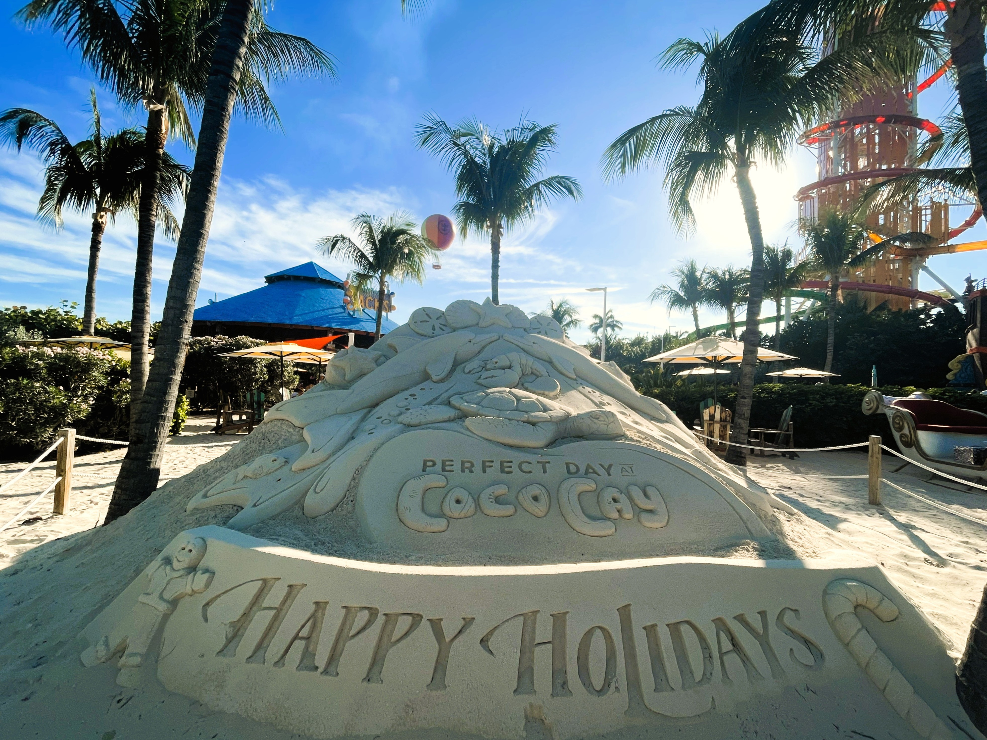
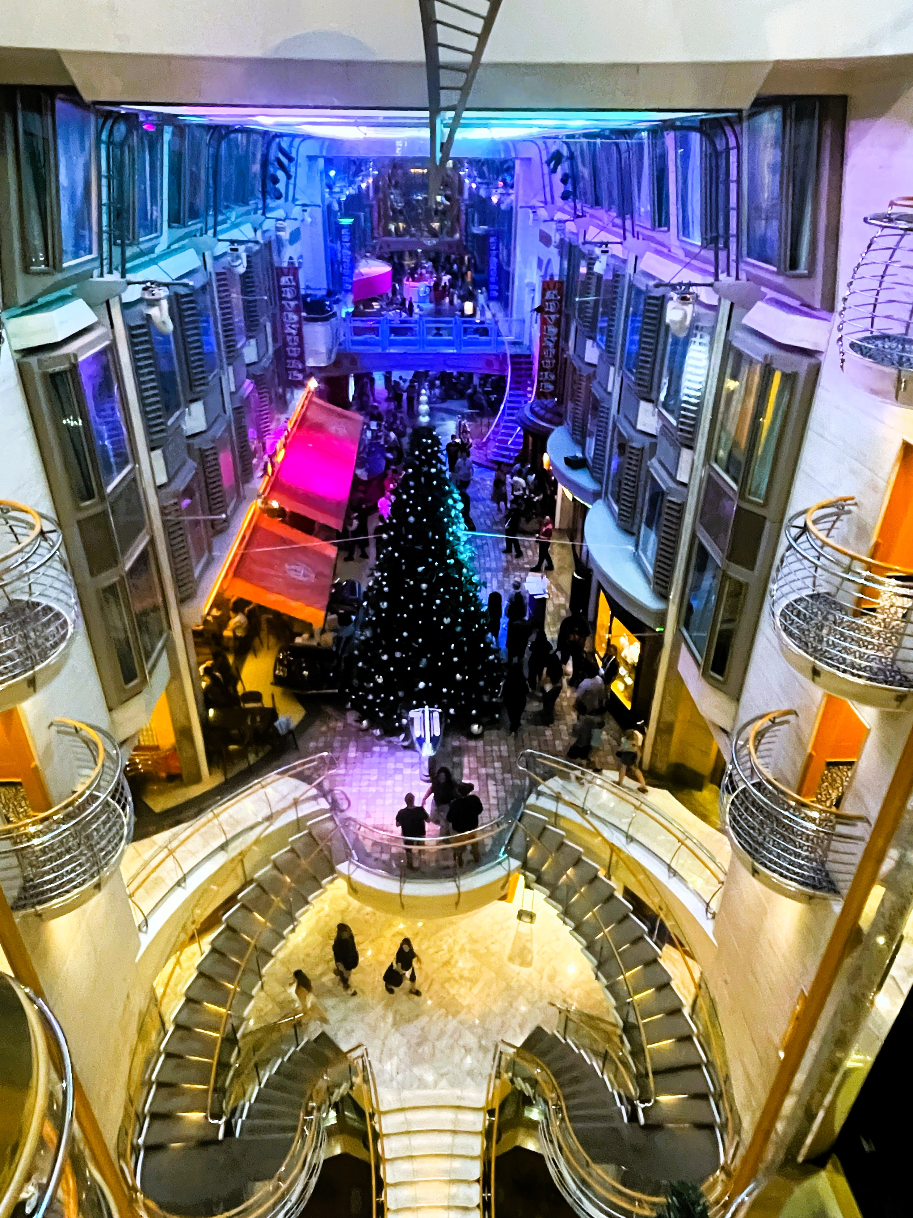
January 2026 marked three years since my curtailment from my last overseas position — and the longest I have been consecutively in one place in the U.S. since January 2009. I have to admit that I am getting some quite itchy feet; I think I am ready to move again. Until then, I continue to do my best to make the most of being posted to Washington, D.C., to give myself and my now 14-year-old daughter C great experiences.
Between the longest government shutdown in the fall, a difficult year that left me with less bandwidth than usual, and the cold and early nightfall that settles in this time of year, I opted to depart from my usual activity-filled seasons. Instead, I decided to mark each month — November, December, and January — with a memorable weekend away with C.
November: Philadelphia
Early on a Saturday morning in mid-November, C and I headed north to Philadelphia to visit Eastern State Penitentiary. I have long had an interest in history and architecture, and this popular tourist spot had been on my list for years. When I learned that Eastern State hosts a twice-a-year Scout Day event, with a kid-friendly program that also allows Scouts to earn the architecture merit badge, I knew it would be the perfect time for C and me to visit.
Opened in 1829 and in operation for 142 years, Eastern State was considered the world’s first true penitentiary. Unlike earlier prisons, where inmates were crowded together and punishment was the primary aim, Eastern State’s goal was redemption through social isolation and reflection, promoting “penitence” by design. When it opened, it was more modern than the White House, with central heating, flushing toilets, and running water in every cell. Its Gothic architecture and central hub-and-spokes layout would go on to influence more than 300 prisons worldwide. Ultimately, the 23-hour isolation model proved just as dysfunctional as the systems it sought to replace, and the practice fell out of favor.
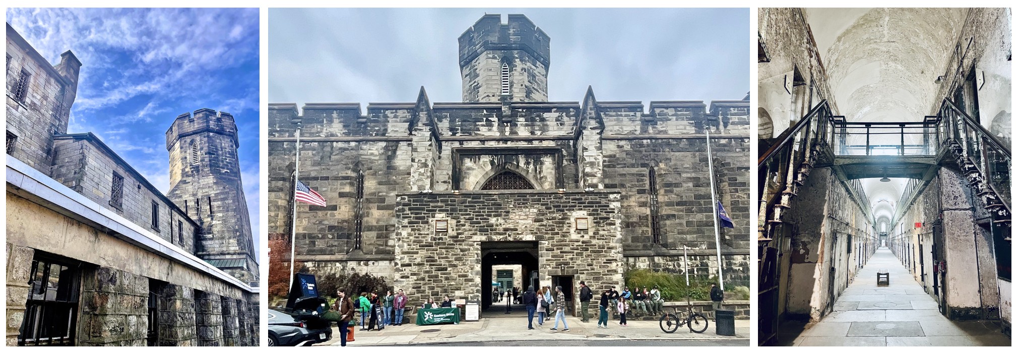
After its closure in 1971, the building deteriorated. However, its designation as a National Historic Landmark in 1965 helped preservation advocates lobby for its protection. In 1988, it opened as a museum and educational facility. Especially interesting is that it was not restored, but left as a stabilized ruin — crumbling cellblocks, peeling paint, and corridors open to the elements (we kept our coats on, as there is no heat). It is a seriously cool place to visit. Scout Day included hands-on activities and discussions with professionals — such as architects, masons, and preservationists. C and I really enjoyed our visit.
After visiting Eastern State, we headed across the Delaware River to Camden. Our first stop was lunch, but the pizza place we were aiming for had bars on all its windows and sat in a neighborhood that did not inspire confidence, so I kept driving until we found somewhere we felt comfortable getting out of the car. After regrouping, we made our way to the Camden waterfront, passing the headquarters of the Campbell Soup Company and the Camden campus of Rutgers University.
We were there for one of our favorite shared activities: visiting an aquarium. We were there for one of our favorite shared activities: visiting an aquarium. We have been to aquariums all over the world, from Shanghai to Chicago, Lisbon to Sydney, and Boston to Tokyo, to name a few. Camden’s Adventure Aquarium is considered one of the best in the United States. It is the only aquarium in the world to exhibit Nile hippos and boasts the largest collection of sharks in the American Northeast.
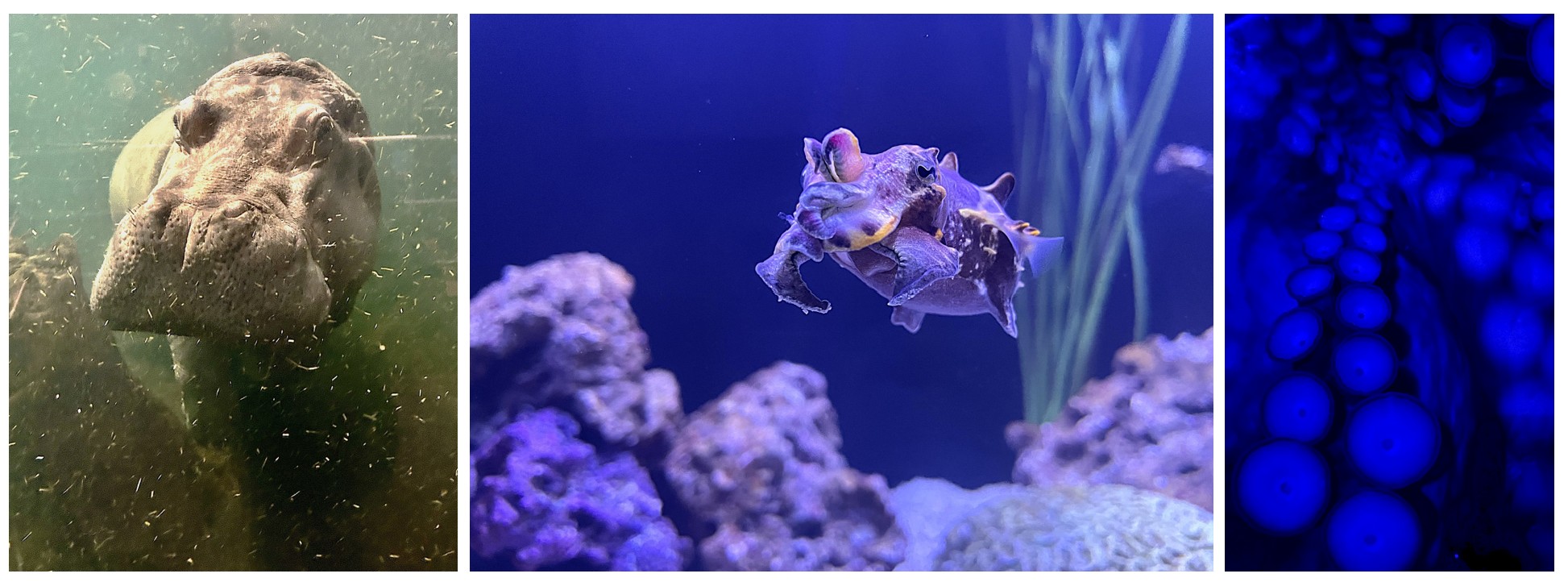
Besides the hippos, Adventure Aquarium is one of only six facilities in the United States to house little blue penguins, and it boasts the largest V-shaped rope bridge in the world — suspended directly above the shark tank for extra effect (rest assured, there is no chance of falling in). We also lingered over a few personal favorites, including the long-snouted seahorse and the flamboyant cuttlefish. Afterward, we walked along the waterfront and watched the sun set over the Philadelphia skyline before making one final stop at a nearby mall so my teenager could fit in a bit of retail therapy.
December: Richmond
On a Saturday afternoon after C’s guitar recital, we headed south to Virginia’s capital, Richmond, about two hours from D.C. Though I grew up in Virginia, attended college down the road in Williamsburg, and have lived in and around Washington for roughly seven years as an adult, I have only visited Richmond twice before. There is always so much to do closer to home, or it becomes one of those places you assume you will get to someday. But, much like when we went to Lancaster, PA, to see Riverdance at a fraction of what it would have cost at the Kennedy Center, I found tickets to Les Misérables in Richmond and decided to build a short trip around it.
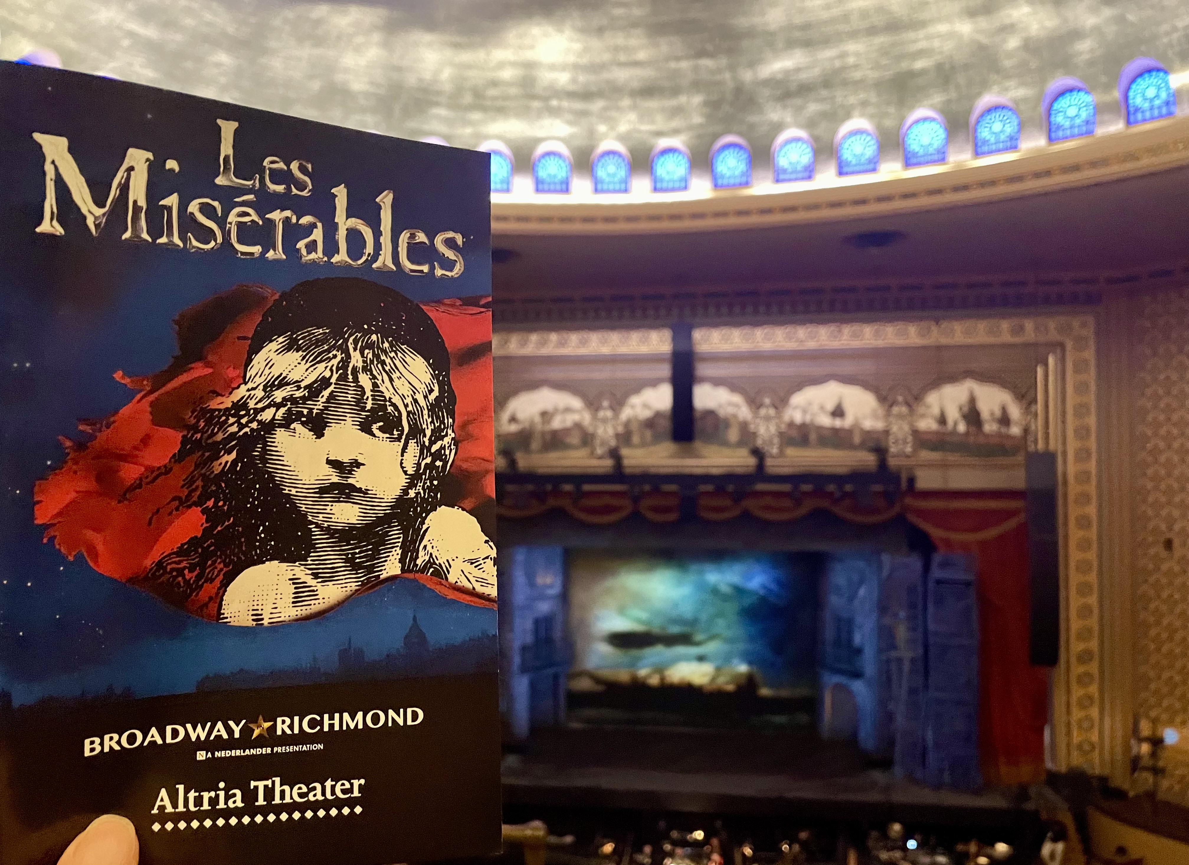
We stayed at a hotel downtown and, at C’s request, had Mexican at a small cantina a few blocks away. Though it was cold, it was not unbearably so — one of those clear, crisp nights where the air feels sharper than the temperature suggests — and we walked to the historic Altria Theater. Along the way, we passed several beautifully detailed buildings that made me think I should return to explore more thoroughly — perhaps without C, who recently informed me that Virginia is largely composed of “historic stuff” and therefore of less interest to her than other destinations. Built in 1926, the Altria is a stunning example of Moorish Revival architecture and a fitting setting for the evening’s performance.
The following morning, we visited the Edgar Allan Poe Museum, which houses the largest collection of Poe artifacts. Given his frequent relocations as both a child and an adult, that is noteworthy. Richmond is where he spent large portions of his childhood. The museum is located in the Old Stone House, the city’s oldest standing residence, dating from around 1754.
I was pretty excited to be back at the Edgar Allan Poe Museum. I had last visited in January 2015 on a quick trip to Richmond to obtain an APHIS signature on documents necessary to take my cats to Shanghai and made a quick spin through the museum to make the four-hour round trip more worthwhile. C was not overly thrilled about visiting a museum in an old house, but when I told her there were two black cats — Edgar and Tib — who serve as the museum’s mascots, she changed her tune.
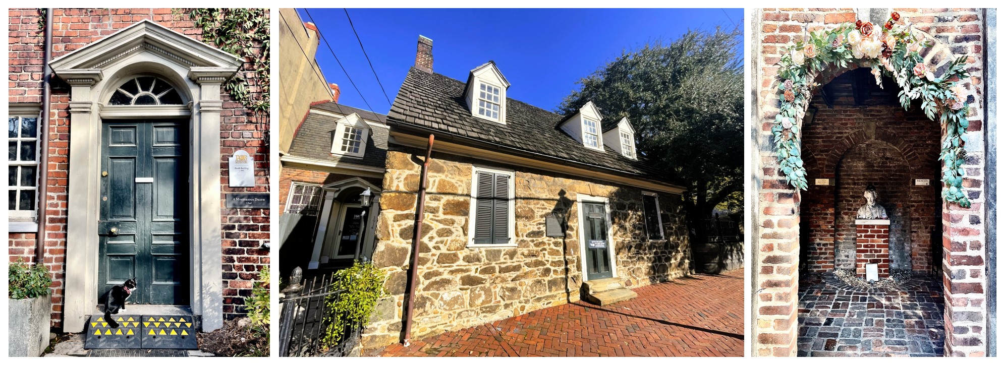
The museum is not large, but it has a bit of everything — original manuscripts, letters, furniture, and personal items alongside film and book memorabilia. The courtyard and additional buildings are not original, but were created as part of the museum in 1922. I loved the small, old brick buildings and the courtyard, and it was fun having one of the resident cats keeping tabs on us; as we moved from building to building, he stayed close. And C, in true teenage fashion, found her greatest enjoyment in the gift shop, where she bought herself a “Tell-Tale Heart” stuffie.
January: Massanutten
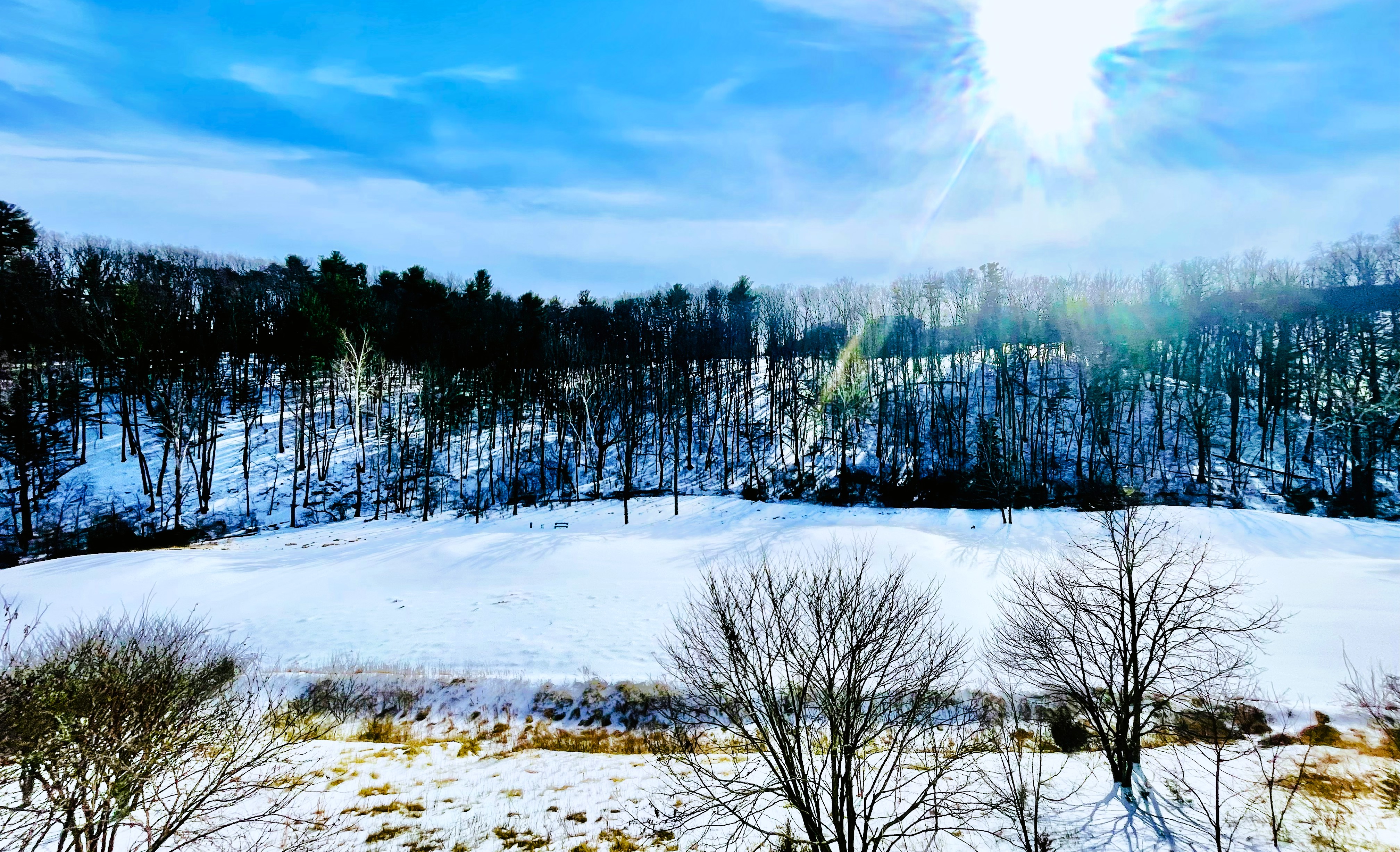
In January, I decided it was finally time to take C snow tubing at Massanutten Resort, a sprawling 6,000-acre resort in the Shenandoah Valley about two hours southwest of Washington, D.C. I had initially planned it to be a mother-daughter getaway, but then realized I could turn it into a birthday celebration for C by inviting two of her best friends to join us.
The weekend before, a snowstorm had dumped about eight inches of snow in Arlington, much of it coated in several inches of freezing rain that turned it into rock-hard, icy “snowcrete.” Schools were closed all week, and the government was for much of it, but by Friday, the roads were clear enough for me to drive. With temperatures still well below freezing, the mounds of icy snow lingered along the roadsides.
We arrived in Massanutten just after lunch in a nearby town, checked in, and — at the girls’ request — made a stop at the gift shop before heading to our one-bedroom condo. We scored an end unit near a snow-covered hill and the woods, and it was beautiful. While I stayed warm indoors, the girls suited up to try body sledding down the hill. When I next looked outside, they were snuggled into a snowbank, talking and laughing.
C and I had only snow-tubed only once before, during our trip to Santa Claus Village in Rovaniemi, Finland. That tubing hill was slightly sloped and very gentle. Not so at Massanutten. The slide drops 120 vertical feet over three steep waves across 900 feet. According to the website, speeds can reach up to 30 mph “depending on conditions.” With the course covered in smooth, ice-coated snowcrete, the conditions were definitely right for very fast tubing.
We stepped onto the conveyor belt that carried us — tubes in tow — to the top of the hill. Once at the summit, we had a tremendous view of the area and the steep slope ahead. What had we been thinking?! The line was short, however, and there was little time to second-guess ourselves before we were flying down the hill on a slide that was equal parts terrifying and exhilarating. I laughed the entire way.
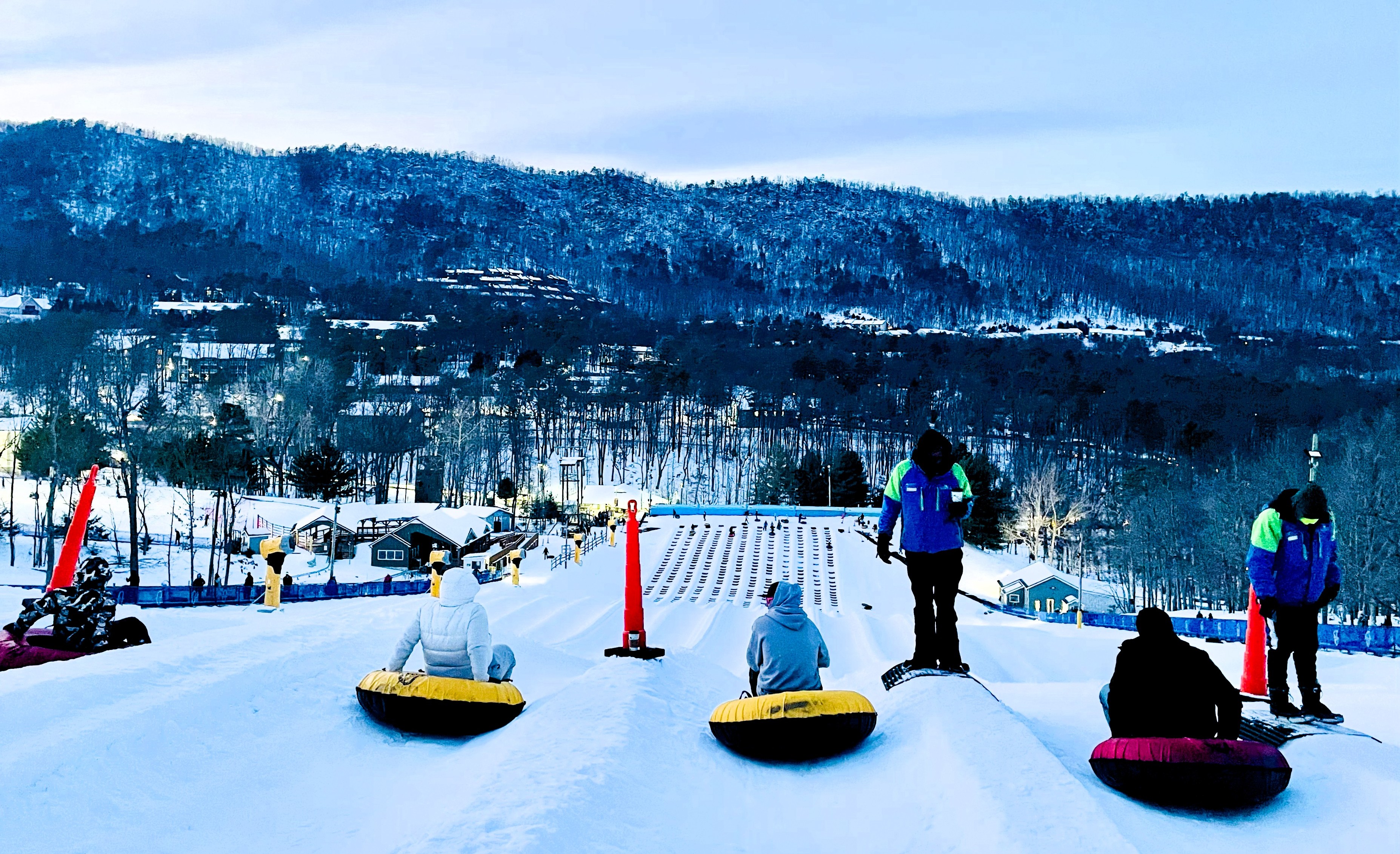
We immediately grabbed our tubes and headed back up for a second run. As the sun went down, more tubers arrived for the night slides — complete with lights and music — and the line grew as the temperature dropped. By our third slide, the wait was even longer, and we were all feeling the cold. Despite my ski pants, my legs were chilled, and my toes — even in fuzz-lined boots — were losing feeling. The girls were complaining, too. Though we still had another 30 minutes left in our session, we called it quits after an hour and a half. Three times down an ice-slicked hill was plenty.
On our second day, we slept in after a late night — me watching television while the girls stayed up talking. We spent a good hour in the arcade, where the girls were highly strategic about selecting games that yielded the most tickets to exchange for prizes. (C and I do love a good arcade.) Afterward, we had lunch at a local diner before returning to the resort for a few hours at the indoor water park. The girls made the rounds of the water slides and lazy river, while I rotated between supervising and enjoying the adults-only hot tub.
Three winter weekends — Philadelphia, Richmond, and Massanutten — each offered something different. Breaking up the season with short getaways gave us experiences to look forward to and shared memories to make in the midst of a season I am not a fan of.


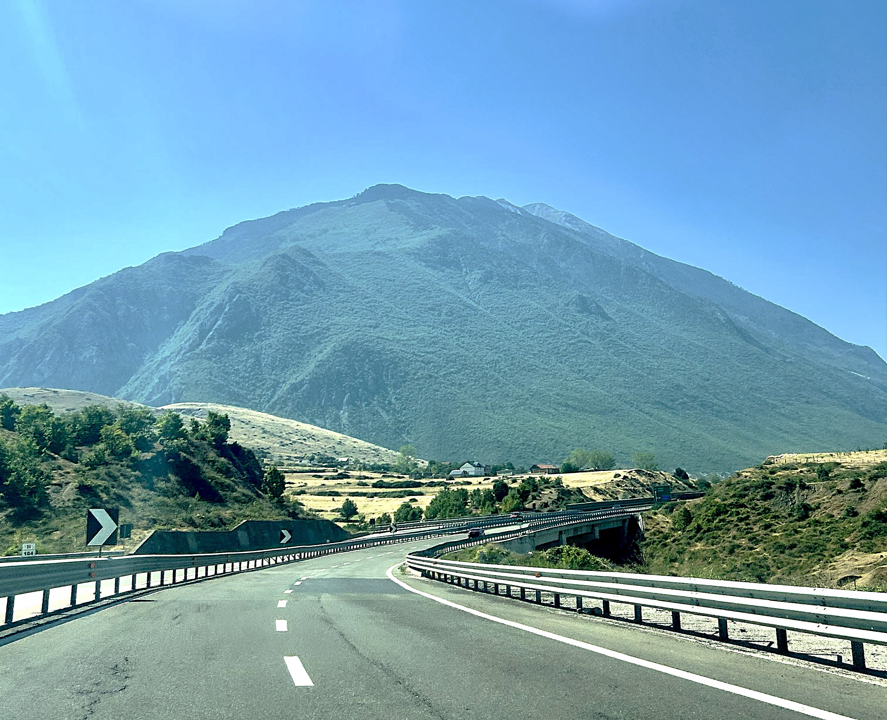


 Americans’ love affair with the car is no secret. In reality, Western Europeans have more cars per person than Americans, but Americans drive their cars for just about anything – short trips, long trips, and everything in between. And when Americans go on long trips, they might be just as likely to pack up the car as to get on a plane. Americans (in general) love a good road trip.
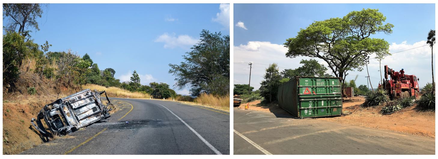
 The paved roads, even the main ones, are predominantly two lanes, one in each direction. Maybe there will be a painted center line, maybe not. Maybe there will be a shoulder, though usually not. Most often the sides of the road are jagged, as though a large monster that eats asphalt has bitten huge chunks off the edges. There are many potholes. Near villages, there will be cyclists, and it seems almost a given that as your car approaches they will begin to weave haphazardly, adding an extra challenge to an already difficult drive. There are also often goats or cattle alongside the road — the cattle are usually accompanied by children or young men, the goats are often unattended and maybe a wee bit suicidal, or at least not phased by traffic at all. However, if you hit someone’s livestock, be prepared to pay up.