2023 Winter Vacay: A Trip Down Memory Lane, Part 5, Mojave and Death Valley

When I planned out our trip, I had a strong desire to drive through the Mojave National Preserve. It would be quicker to drive using larger roads such as CA-247 to Barstow and then Interstate-15, but I was not necessarily looking for the fastest route. That way would not take me through the Preserve. Then again, I did not wish to be long delayed and there was a risk that driving through the Preserve we could be held up for as long as an hour by railway siding operations at the Kelso Depot. I opted to take the chance.

Road through the wilderness on Amboy Road

We left Yucca Valley early as there was a long drive ahead to Death Valley National Park. Soon after leaving Twentynine Palms, it was as if civilization disappeared (well, except we were on a nicely paved road). There was desert, scrubs, hills, and sky. There was little else until we hit the junction of Amboy Road and I-40, and the teeny, tiny town of Amboy.

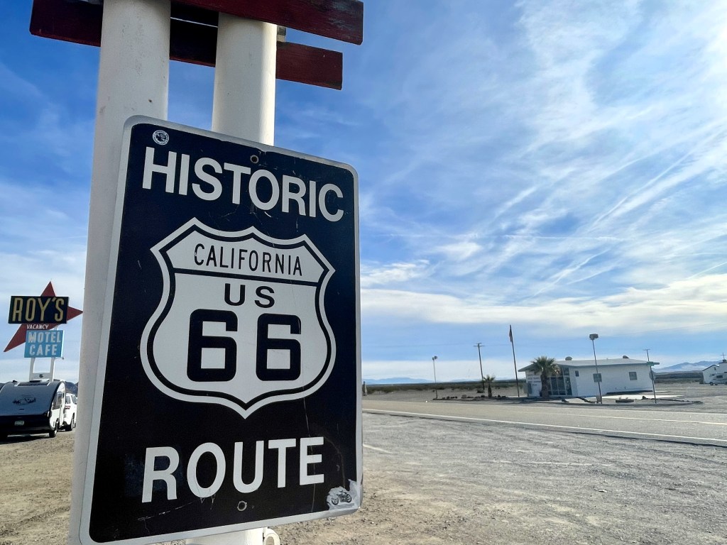
Amboy historic sign with a view of the post office building and Roy’s

A historic 1850 railway station settlement and later popular stopover on the historic Route 66 highway, Amboy is now just a shadow of its former self. It still boasts the old post office building, though services appear permanently closed, and Roy’s Motel and Cafe (and service station) dating back to 1936. Online information says these businesses are run by the four people who still call Amboy home, though when I asked the guy behind the counter if he lived in town, he gave me a good long suspicious look, asked me if I were a journalist or something, then told me, no, he does not live there but he drives in from about an hour away. I liked the nostalgic symbols of the 1950s travel heyday–the diner, the roadside motel signage, and the Route 66 sign–but I did not wish to linger; the place felt trapped in time. Most of the other towns that once existed in the area have been long deserted.

We drove on taking Kelbaker Road through another wilderness area and into the Mojave National Preserve. For a long while the preserve looked little different from the other stark landscapes thus far that day. I know there was much more diversity in the terrain off the main road, but as our time was limited, I had to make do with the drive-through. Once we crossed over the railroad tracks at Kelso, then safe from the potential cargo train delays, I took the opportunity to make a quick stop.
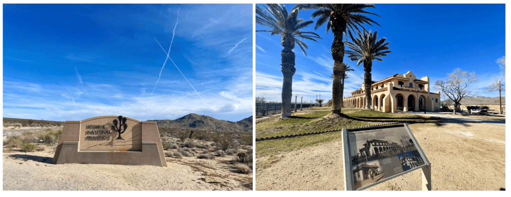
The southern entrance to the Mojave National Preserve and a stop at the historic Kelso Depot

The Los Angeles & Salt Lake Railroad built the Mission/Spanish Colonial Revival Kelso Depot in 1924, replacing the earlier building from 1905. The once thriving railroad worker town had long ago fallen into disrepair although there are still some workers living on the other side of the tracks and the National Park Service is preparing the building to house a visitor center. That day I met a National Park ranger and an intern with brochures, pins, and stickers on a table in front of the building; they were happy to answer questions. Again, I could not linger because I still had a long way to drive and also C refused to get out of the car to even read one information plaque. So, I got back in the car and continued north.

C stands in the desert alongside CA-127 as we await the green light to move past the road construction

It was another 40 minutes through the desolate Mojave desert to the town of Baker and then north again on CA Road 127. About 30 minutes north of Baker we were stopped by road construction. There was already a line of several cars and motorhomes. I wandered up to the lone construction worker holding the stop sign and asked how long the wait would be. He said we needed to wait for the “escort car” and it could be about an hour. Big sigh. There was nothing to be done about it though. There was no telling how long it would be for that “escort car” to arrive as looking ahead I could see no road construction at all. I used the port-a-potty (thank goodness they had one as I had been swigging down the water) and moseyed back to the car. Other travelers were wandering off into the desert alongside the road. Some were already quite far from the road. No one expected this to be a short stop. I alternated small talk with the guy on the motorcycle behind us and hanging with C in the car or on the roadside. It was about 45 minutes in total before the escort vehicle leading the group of cars from the far side of the construction came through.

The Ranch at Death Valley seemed an almost impossible oasis surrounded by an unforgiving otherworld.

We were now quite far behind schedule. C fell asleep in the car. My eyes glazed over the scenery as we drove on, and I took little in. Despite the occasional breathtaking view, the pretty oasis town of Shoshone, and the rather bizarre Death Valley Junction, reported to have a population of “less than four people” and a boarded-up building with an “opera house” sign, the view was mostly the same bland tan sand stretching for miles. From Death Valley Junction we turned west toward Death Valley and within 30 minutes we were pulling into the oasis that surrounds the resort complex of the Ranch at Death Valley, our accommodation for the next two nights. With a park the size of Death Valley, the largest in the contiguous United States, I knew we would want to stay inside rather than outside.

The stunning sunset at Zabriskie Point

As the drive had taken longer than expected, we had only so much daylight left. We checked into the hotel quickly and then drove back to Zabriskie Point. We arrived just around 3:45 PM, luckily scored a parking spot immediately, and sped-walked up the paved walkway to the viewing area. Spread out ahead of us lay the undulating convolutions of sentiment carved after millions of years. Breathtaking.

We had an hour to wait for sunset so we walked down to a dusty plain below. Perhaps the flattened area and dust left after years of borax mining in the area? We goofed off a bit and then climbed back up to watch an absolutely stupendous sunset.

In the morning, we made our way to Badwater Basin – the driest place in the U.S. and at 282 feet below sea level, also the lowest point in North America. At the time though, Badwater Basin was actually not dry as a small lake had formed after heavy rains the previous summer and some of that water yet remained. I had looked forward to photographs of the geometric salt polygons, but instead, we found piles of salt sticking up out of a glassy, shallow lake, like lumps of sugar in a giant cup of tea.

As we drove back from Badwater towards the Ranch, we stopped at the Devil’s Golf Course, an expansive plain of jagged salt crystals, and the Artist’s Palette. At the latter, we parked far from the site and walked over a few hills to get to the view of the swath of colored volcanic deposits on a hillside. Honestly? The palette was smaller than expected and lacking in variety; it was mostly a chalky mint color with a small spray of pale pink against the predominantly golden dirt. Still, it was fun to get there – especially after climbing up and over a few hills to then see a parking lot just below the palette…

The ruins of the Harmony Borax Works at Furnace Creek, Death Valley

Following lunch back at the Ranch, we drove only a short way to the site of the Harmony Borax Works, listed on the National Register of Historic Places. The 1880s to the early 1900s marked the heyday of borax mining in Death Valley. Harmony was the mining operation that opened the valley to large-scale borax mining and was famous for its use of 20-mule teams that hauled the borax across the valley to the railroad 170 miles away in Mojave, California, though it operated only five years from 1883-1888.

I then drove us 30 minutes to the Mesquite Flat Sand Dunes. As we had for the whole trip, we were racing the early winter sunset. Arriving at 3:30 PM, we would have an hour to crawl around the dunes before we would lose the light. Though large areas of sand dunes are not plentiful in Death Valley and the Mesquite Flat Sand Dunes are not the only ones, they are both lovely and very accessible, sitting just off the park’s main road.

The sun sets on the Mesquite Flat Sand Dunes

C and I climbed up and down the dunes, our feet sinking deep into the soft sand. We were having fun running hand and hand down the dunes until C smacked me in the face with the shoes she held in her hand and swung wildly as she ran. I opted to lope down the dunes beyond arm’s reach from her after that and to video her cinematic rolls and crawls on hands and feet. We watched an foolish driver in the distance with their car hopelessly stuck in the sand (an alerted ranger had to call in a team to get them out) and another foolish guy flying his drone above the dunes, expressly against park rules. But mostly there seemed a lot of happy people sitting or strolling on the dunes. Here we all were, experiencing the stark beauty of one of the most inhospitable places on Earth.

After the sun slipped below the horizon we headed back to the car and drove back to the Ranch. Though we had reservations in the fancy dining room there, we canceled them. After a day of exploring and hiking, we were up for a quiet night before we would depart the park the next day.
2023 Winter Vacay: A Trip Down Memory Lane, Part 4, Joshua Tree

On Christmas morning, C and I woke not to stuffed stockings or piles of presents beneath a tree (we had done that the Sunday before we started our trip), but to a travel day. Today, we would completely depart from the itinerary of my 1984 family trip to Los Angeles. We were driving to Joshua Tree National Park.

C prepares to dance atop the rocks

Among C and my favorite things to do (besides seeing Broadway musicals, visiting aquariums, enjoying amusement parks, and eating at Hard Rock Cafes) is visiting National Parks. A big part of deciding on southern California for our winter holiday was the chance to visit some of the parks I have long wanted to. I wondered why my mother and Aunt L had not made Joshua Tree, just a 2.5-hour drive from Los Angeles, part of our 1984 vacation. Though they were not particularly outdoorsy, the bigger issue was that Joshua Tree did not exist as a national park in the 80s. President Franklin D. Roosevelt established Joshua Tree as a National Monument in 1936, but it did not become a National Park until 1994.

Sign at the West Entrance station to the park

C and I packed up, had breakfast, and called an Uber to take us to Los Angeles International Airport, where I had a rental car waiting. As it was Christmas, I fully expected another Chinese-American Uber driver, but instead we had an Algerian American transplant from the mid-west with a love for Italian pop music. As we cruised easily through the largely empty streets, I recognized the songs but could not place them. When I asked the driver, he told me it was Eros Ramazzotti, and I was transported back to the summer of 2000 when I backpacked through Europe and first heard these songs. This trip was giving me more travel flashbacks than I had anticipated.

Getting to the airport went quickly enough, but there was a long line at the car rental office. It took an hour to get through it, so we were on the road later than I had hoped. Still, the traffic, even on Los Angeles’ notorious freeways, remained light and soon enough we were beyond the city limits and heading into the desert.

We arrived in Yucca Valley, California, population 22,000, one of the small cities that lie along the northern borders of the National Park. We checked into our motel and grabbed a bite to eat at the nearby Denny’s so that we might get at least a little time in the park. I was reminded again that travel in the winter restricted our sightseeing with the sun setting so early, around 4:45 PM. Yet, summertime visits to the desert mean scorching temperatures.

Some of the vibrant flora of Joshua Tree

The drive to the West Station entrance of Joshua Tree National Park is 25 miles from our hotel in Yucca Valley. The winding road took longer than expected and the line to enter the park was also unexpected. But the park is popular for night sky viewing and camping, and it would seem the Christmas holiday is an excellent time to do it. So, once I purchased our annual America the Beautiful park pass from the ranger, we only time for a 30-minute drive in and a few photos of the eponymous trees set against rock formations and a pinkening sky before it was time to turn around. It was a great introduction to the stark beauty of Joshua Tree. C very much wanted to get out and run around and made me promise to let her scamper over the rocks on our return.

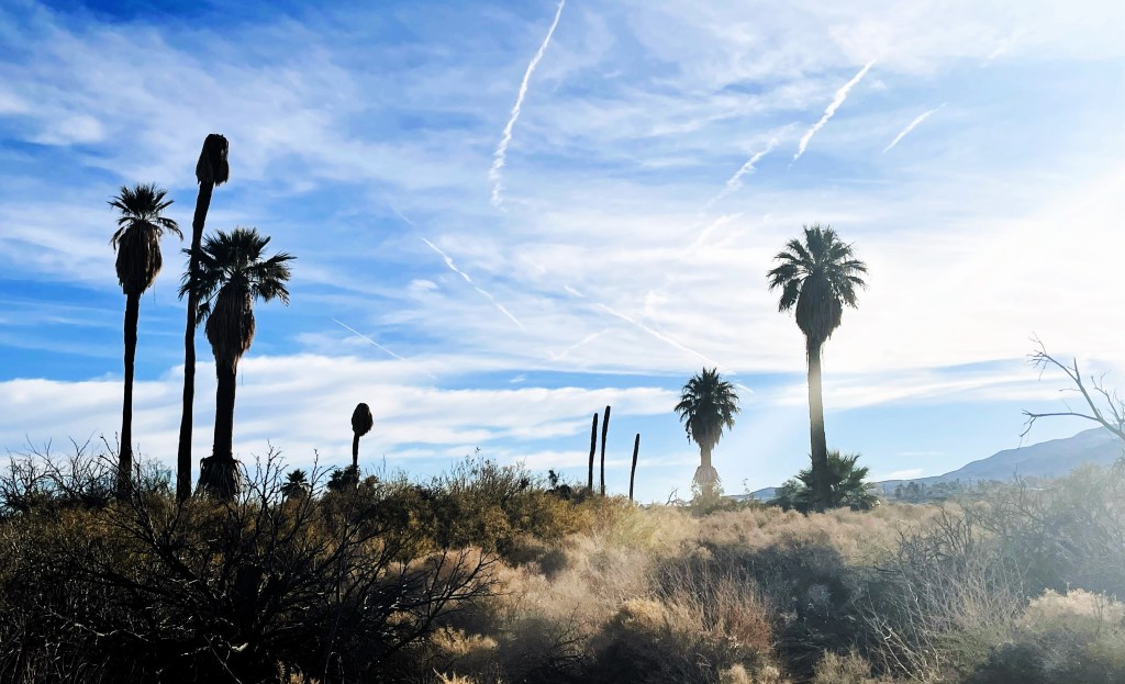
Bright sunshine over the grasses and palms of the Oasis of Mara

On our full day in Joshua Tree, we drove down the highway to Twentynine Palms to begin with the Oasis of Mara, north of the park’s north entrance. Unlike much of Joshua Tree, where the flora are primarily succulents, like the Joshua tree, the oasis has palms and grasses that survive with the underground springs. The indigenous Serrano people named the area “Mara” meaning “the place of little springs and much grass.” C and I enjoyed a little stroll around the oasis area.

Then we entered the park at the North Entrance. We turned off from the Park Boulevard and onto Pinto Basin Road. Soon after the turn off we came to our first grouping of large rocks at the Belle campground; C insisted we stop. She needed to climb! After a good long stop for rock scampering and photography, we drove on to the next stop at White Tank. The rock formations are impressive. These are actually not mere rocks, but massive granite boulders piled atop one another. Some more scampering on rocks occurred – with me joining in! – before driving on to the next site.

A cholla cactus stands out from the crowd

The Cholla Cactus Garden is an area just off the main road blanketed with some 10 acres of the cactus known as Teddybear cholla. These cacti certainly look cute and fuzzy but are anything but with extremely sharp barbs with a reputation to painfully latch on to passersby. There is a pedestrian trail, partially boarded, through these plants but one can get as close as one dares. That surprised me. Given the silly things that some people get up to in our national parks, visitors are still given quite a bit of leeway. After about a half hour there, C and I departed unscathed. We had already been in the park several hours and it was time for lunch. I had opted to drive out of the park into Twentynine Palms for lunch rather than to pack one. We grabbed lunch at a Tex-Mex place in town and then returned to the park.

Our first stop was Jumbo Rocks. It is an apt description as the size of the rock formations and boulders were easily the biggest we had seen that day and spread out over a larger area. This campground also seemed more popular and the crowds of visitors were larger than we had run into in the boulder areas off Pinto Basin Road. We parked where we could and followed the parking lot to a trailhead into the boulders. I think we got off the Jumbo Rocks trail on to the Heart Rock and Arch Rock trails. Then C just wanted to climb over whatever she could in whatever direction took her fancy. There were points – like around Heart Rock – where we saw many other people, and others where we might see no one else for a five minutes or so. We completely lost track of time. The weather was beautiful, the temperatures warm but very comfortable, and the sky sapphire blue. It was just us climbing up and down and between rocks.

Heart Rock and Skull Rock in the Jumbo Rock boulder area

But I knew we had only such much time given the early winter sunset. We made our way back to the car and drove on a little ways to the Skull Rock area. There we did more climbing amongst the rocks, but we did not have time for the same carefree wanderings. I wanted us to get to Keys View for the sunset with a stop at Hidden Valley along the way.

Unfortunately, at Hidden Valley the parking lot was completely full. I drove through four times very slowly – and we were not alone in doing this – but a spot never opened. I gave up and drove towards Keys View but there too we ran into an issue, the road was closed off with a sign “Road opens just before sunset” and a ranger standing sentinel to make sure visitors obeyed. But it was not long til sunset. As I turned around and left the turn off, rangers were closing off more of the road, not opening it. We would not get to visit one of the park’s primary sunset locations. I turned back toward Hidden Valley hoping we might still have a chance to visit and lucked out with a parking space on my third time through the lot.

Sunset at Hidden Valley

I planned to find the Hall of Horrors, a slim chasm between two high rock walls. I had read about it before the trip and wanted photos of C standing with legs and arms spread touching both sides of the Hall. I failed though to note the coordinates of the Hall and we wandered about aimlessly for 20 minutes without finding it or even a clue as to where it might be. C was chomping at the bit to get some more boulder climbing in and begged me to give up our search. Disappointed, I did.

Yet as the sun set across the boulders, desert, scrubs, and Joshua trees at Hidden Valley, we were treated to a magnificent burst of orange as the blue deepened in twilight. Perhaps sundown at Keys View was great that day, I do not know, but it was definitely perfect at Hidden Valley.

We ate a simple dinner from the supermarket in the motel room that night as we relaxed from our day of climbing adventures. I would have liked another day at least in Joshua Tree, but the following day would be a travel day on to our next destination.

2023 Winter Vacay: A Trip Down Memory Lane, Part 3, La-la-land

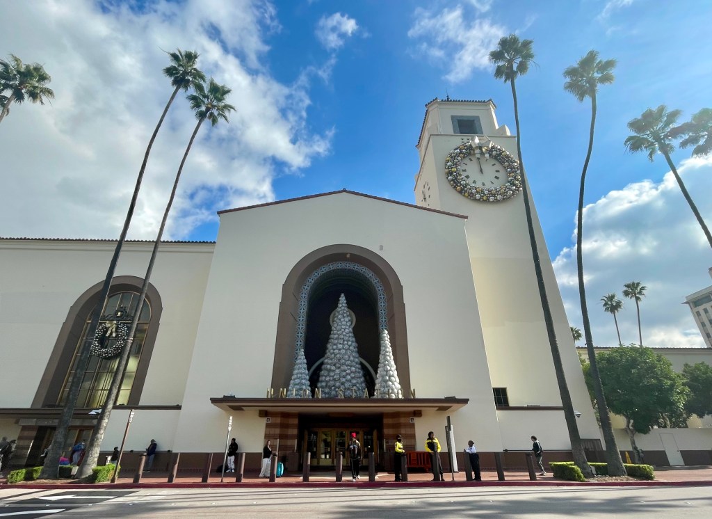
Los Angeles’ beautiful Union Station: where I arrived in the city in 1984 and 2023

In 1984, when my family traveled to Los Angeles by cross-country train, we stayed with my mother’s cousin in Dana Point, about an hour south of the city center. This was not a part of the trip I wanted to recreate. Though C and I did visit that cousin when we went to California in 2016, she had moved to Carlsbad. That house from 1984 later slid off the cliffside. 

Instead, I had booked a hotel very close to the Hollywood Walk of Fame and the Chinese Theater, two sights I do remember us visiting in 1984. I did not want to drive around Los Angeles if I could avoid it. In 1984, mother and aunt rented an automatic transmission car that neither could drive very well (they were used to manual cars and my mom kept hitting the brake thinking it was the clutch), which made city driving even more….challenging. C and I could get to the sights we wanted to see on foot or by Uber.

Arriving three hours late following a 43.5-hour train ride, C and I were very eager to get off the train, get to the hotel for showers, and then for a walk to really stretch our legs. The sun was shining, the palm trees were swaying, and the temperature was in the mid-60s. 

Grauman’s Chinese Theater – it looks much the same as in 1984, only with some added digital screens and some shorter and more efficient cars driving past

Our luggage arrived quickly and I called an Uber. Our driver had his GPS set to Mandarin Chinese so I thought I would speak a little and this delighted both myself and the driver. At the hotel, we were lucky to be able to check in early, something we probably would not have been able to do had we arrived on time, so we also freshened up before hitting Hollywood Boulevard. 

Most of the walk to the Chinese Theater was quiet, that is until we turned onto the Boulevard itself. It was packed full of tourists, vendors, and folks in cosplay working the crowd for paid photo-ops. We saw people dressed as Freddy Krueger, The Mask (the Jim Carrey movie), Michael Jordan, the Joker, Spiderman, Mickey Mouse, a Transformer, and many more I just do not recall. There were a lot and it was hard to get past some of them. We popped into the Chinese Theater courtyard – mostly so I could tell C it was the same place I had visited when I was 11. And that was it. That was all we did in 1984, too! 

We got lunch at the Hard Rock Cafe. It has become a bit of a tradition for C and I, with us having dined in at least six Hard Rock establishments in the past three years. We were rather desperate to sit down at a table and eat in a restaurant, i.e. not fruit and granola bars from a bag at our coach seats. And there was the sensation still of rocking back and forth as if we were still on the train. The food and drink restored us and we were then able to get out and about.

I focused on seeking out the Hollywood stars that would have been on the Walk of Fame in 1984

We spent the rest of the day checking out various shops, especially Japanese and Korean fashion and goodies shops, and looking at the various celebrity names on the stars of the Hollywood Walk of Fame. At the time of my visit in 1984, there were around 1,770 Walk of Fame stars; but in December 2023 there were 1,000 more. We walked down to Thai Town, the only such ethnic Thai neighborhood officially recognized in the U.S., as C had a specific store she wanted to visit. On our walk back, we passed lines of vintage cars along the Boulevard. It was Saturday night and the classic and lowrider vehicles were out cruising.

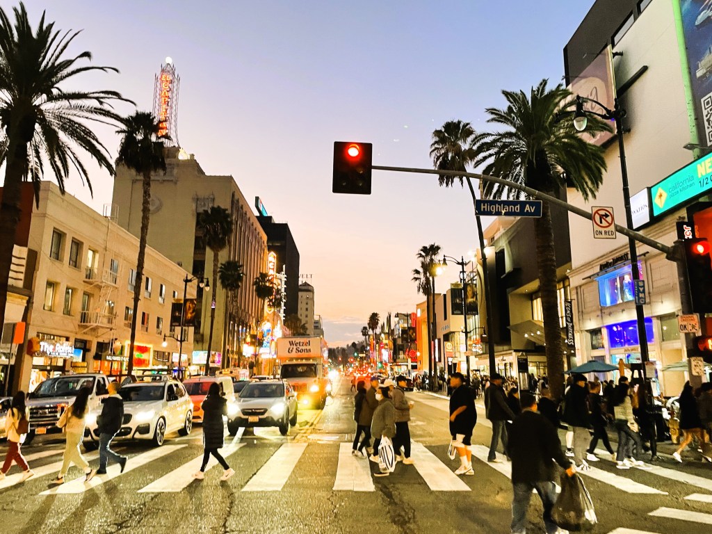
Hollywood Boulevard lighting up as the sun goes down

On our second day in Los Angeles, C and I went to Universal Studios Hollywood. During my 1984 visit with my family, a visit to the theme park had been one of the highlights. This would be C’s first visit to a Universal Studios amusement park and we were eager to get on as many of the rides as we could. I especially wanted to take C on the famous Tram Tour, one of the few parts of the visit I remembered. The part of the tour with the mechanical great white shark from JAWS was seared into my memory.

Once in the park, I realized almost none of the current attractions would have been part of my 1984 visit. C and I were really looking forward to the Wizarding World of Harry Potter, but think about it, the first Harry Potter book was published in 1997, 13 years after my trip to Los Angeles. The Revenge of the Mummy ride, the one C and I made a beeline for as soon as we got into the park, is based on the popular Mummy movie franchise; the first of those movies was released in 1999. The Kung Fu Panda Adventure? Based on a movie released in 2008. C and I were able to get on nearly all the rides at the park. Because the temperatures were in the 60s, we opted to skip the water-based ride as we did not want to get wet. I remembered teasing my younger brother about the Jurassic Park movies way back when, but then with the first one released in 1993, it did not go back quite as far as our 1984 trip. Even the Simpsons ride, though based on television’s longest-running American primetime show, would not have been around back then. The show first aired in December 1989. Oh my, I was starting to feel old.

This building facade is based on the Despicable Me movie, which came out in 2010

The Universal Studios Park of 1984 (there was no need to designate it as the park in Hollywood as it was the only one of its kind: the park in Florida opened in 1990) was largely just stage shows. Animal shows, stunt shows, shows based on specific TV shows, and the tram tour. I remember seeing an Indiana Jones show. The first movie opened in 1981 and I had seen it probably 20 times. It was my favorite movie!

At least the tram tour through the Universal Studios backlot still has a few stops from 1984 – JAWS, the flash flood, and the Bates Motel. The icy tunnel, the collapsing bridge, and the terrible Battlestar Galactica sets were no longer there. It was kind of a shock to me to pass by the courthouse square that was such a huge part of the Back to the Future movies (my second favorite after Indiana Jones) and realize it would not have been there in 1984, as the first of the movies was not released until the following year. And yet my almost 12-year-old kiddo stared blankly at the set, as she was unfamiliar with the movies.

We spent all day at the park. It was Christmas Eve, and though the weather had been lovely all day with the sun up, as the sun set, it grew chilly. It was time to head back to the hotel to get some shut-eye before the next phase of our trip.