As part of my blog, I sometimes find former travelogues I sent to friends and family of my travels before I joined the U.S. government and brush them off, spiff them up, provide some context, and then publish them here.
This is about my attempt – and ultimately, failure – to climb Southeast Asia’s largest mountain, Mount Kinabalu, located in the Malaysia state of Sabah on the island of Borneo. It is more an uphill walk than a climb, with casual climbers making the round trip in two days. Most climbers begin in the morning on day one climbing for three to six hours to a location approximately two-thirds of the way up where they overnight; then in the early morning hours they start the final ascent, returning to the base the same day. I would make this trip with my Indian friend AG, whom I had met when I studied for a master’s degree at the National University of Singapore, 2002-2003. He and a group of friends also from India had made the climb the year before.
It seems almost unbelievable to me that this trip took place in September 2005, already 17 years ago. But I enjoy going back through my old travel stories to remember the amazing things I have done. Sometimes I wonder what this younger woman was thinking! I also revisit this story at a time when we have been in the pandemic for two years and our travel has been very limited.
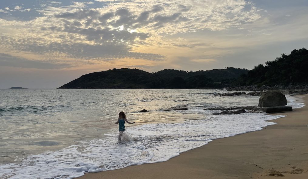
As per usual when I share stories of my former travels, I try to include as much as I can of what I wrote then and supplement with background information on the place and my memories. I have few photos of this excursion, largely due to the poor weather that provided few views of anything other than fog, scrubs, and muddy trails as we climbed. I imagine I was also just too tired. Though I do remember that during the summer before this climb I often put weights in my backpack and took long walks around Washington, D.C., to prepare for the hike, walking at near sea level on flat surfaces was not enough.
The mountain adventure begins with a stunningly long journey from the U.S. east coast to the Malaysian state of Sabah, located on the northeastern corner of Borneo, the world’s third largest island. This would not be my first trip to Borneo as I had visited the country of Brunei, the Malaysian state of Sarawak, and into the Indonesian state of West Kalimantan in July 2003. I had also previously visited Brunei in February of the same year.
I flew two hours from Washington, D.C. to Chicago, then 15 hours to Hong Kong, then three hours to Singapore. I arrived late the next evening. I spent three full days in Singapore catching up with friends and trying to shake some of the jet lag. On the fourth day, AG and I took a taxi from downtown Singapore to the Malaysia border. Then another taxi to the Senai International Airport and a two-hour flight to Kota Kinabalu, Sabah’s capital. Fun fact: Sabah used to be known as “Api-Api” meaning “Fire, Fire” because it was burned down so often by pirates (or so I read when I was researching my graduate thesis on maritime piracy in the region). We stay one night in Kota Kinabalu and the following morning we wake up early to catch a minibus for the two hour trip to the park entrance of Kinabalu National Park.
I could not have traveled much further away from Washington, D.C. than the mist-dusted slopes of Southeast Asia’s tallest mountain – the tallest mountain between the Himalayas and Papua New Guinea. At 4,095 meters or 13,435 feet above sea level, Mt. Kinabalu (meaning house of the spirits of the dead) is the youngest non-volcanic mountain in the world and is apparently still growing by approximately five millimeters per year. This mountain would be my challenge. I had wanted to climb this mountain before when I lived in Singapore, but when SARS hit travel plans were squashed and I let this idea go for a while. I wasn’t sure I could climb the thing anyway. It is one of those things like training for a marathon that one says they might like to do but never seem to work up the gumption to do. Oops! I AM training to run a half marathon this year. And so, it seemed time to put my mountain trekking dreams to the test.

Up until the time that my friend AG and I set out on the trail to the top, I had a hard time imagining myself really going up the mountain. It then was no surprise to me that when we arrived at the park headquarters on Thursday that we were told that accommodation on the mountain was fully booked. Ah, here then was one of those times when my devil-may-care attitude toward reservations (and apparently AG’s too) was going to get the better of me. We tried; we really did. We asked about sleeping on the floor, about cancellations, about other ways to stay on the mountain. The hotel however only suggested that maybe we could climb up and down the mountain in one day. This option most definitely did not appeal to us, but still, we asked a guide about this option, and his look clearly indicated this would be on this side of crazy. (It seems these days permits for a one day climb are no longer offered) So, we accepted this temporary setback, made our accommodation bookings, paid all our fees for the park and guide, and then made our way to the lodge where we would be stay that night.
As we could not check in to the hotel until 1 PM, we joined a nature walk through a nearby botanical garden to learn about the flora of the area. Kinabalu Park became Malaysia’s first UNESCO World Heritage Site in 2000 due to the incredible diversity of its flora and fauna. The main plants to see – or rather what I wanted to see – were some of the orchids and the oddly fascinating pitcher plant, a carnivorous plant shaped like a pitcher with an umbrella cap. The pitcher fills with digestive fluid, bugs fall in, and the plant devours them. Even if the insects try to climb out, the downward pointing spikes at the lip of the pitcher prevent them from escaping. Really cool.
Our money was limited. I had tried to change a U.S. 100-dollar bill when in Johor (Malaysia) before flying to Sabah, but the money changer refused. Apparently the 1996 series of bills had been counterfeited one too many times by some Southeast Asian mafia. And AG’s ATM card was not working. Luckily our credit cards were accepted so we were paying for as much as we could with them to conserve our little cash. I had planned to keep expenses modest but with our spirits dwindling I opted instead to shell out big time – thus we dined very fine, stayed in a luxurious room, and had drinks by the lodge fireplace. (Unfortunately, I never wrote down the name of the lodge where we stayed. I tried searching online for clues but with nearly 20 years between now and then, I just do not know. But I recall the room – a two story loft with a sitting room with massive windows on the first floor and a king-sized bed with super soft sheets upstairs – was fancy indeed. And we watched the news that night on the large television and learned of the death of Supreme Court Justice William Rehnquist. We would have missed that had we been on the mountain.) As the rain poured down outside – though September was supposed to be still the dry season – we wondered if we should not just hang out in the lodge for three days. But I was there to climb that mountain!
Early on Friday morning we were up for breakfast. There we met a couple who had returned the day before. Although they said it had been cold and wet and their legs were now so stiff so they could not walk properly, it was “brilliant.” They passed on their walking sticks and told us to buy gloves (because one pair would get wet) and the cheap emergency ponchos to cover our bags. We made the requisite purchases (with credit card of course) then off to the park headquarters where we met our guide Janeul.
Every climbing group must have a licensed guide. Yet it was not all that clear that there was much training involved in one becoming a guide. AG said it was simply job creation, that all one needed was to be fit enough to go up and of stoic enough personality to climb the mountain again and again and again leading all manner of tourist. It was pretty clear early on that one did not need to have strong communication skills to be a guide. Janeul immediately, though in very few words, informed us he would be taking us to the Laban Rata guesthouse. Unfortunately, we would not be staying there since we had not made advance reservations, Laban Rata remained full and we had had to take accommodation in the unknown-to-us Waras Huts. AG tried to correct the guide but who only then repeated “Laban Rata” and “Please wait here five minutes.” AG noted again that we needed to go to the Waras Huts and Janeul again repeated, “Yes, Laban Rata.” So we gave up. We had the whole walk up to set this guy straight. (Though it turned out of course that we did have to go to Laban Rata to check in)
A minivan took us to Timphonon Gate, which marks the start of the mountain trail. There, decked out in our start of trek gear – shorts and t-shirts with our rain jackets tied around our waists and our small packs on our backs and our walking sticks in hand – we began. The first 50 feet is downhill, and I said, “Oh this is great!” and AG said, “Yes, Mt. Kinabalu is 4100 meters below sea level.” Ha Ha Ha! Just before the trail slopped upwards, we stopped at a small waterfall; it would be our sign when we returned that we were almost done. From there it was literally all uphill.
The first part of the trail is dirt with steps fashioned out of tree limbs and wood, clearly put together by someone with a special hatred of trekkers. These were monstrously sized steps and it seemed slow going. But we had sun and it looked like it would be a beautiful day. By the time we reached the first of the rest stops 30 minutes in I was feeling a little tired, having not quite yet hit my stride. But AG said it had taken him and friends over an hour to reach that stop the year before and I felt buoyed. We rested just a few minutes and then set out again. The sun was still out, and the mountain was lush and green. But the trees were thick, and we were still fairly low, so there were not any views.

Within half an hour the rain started to fall. It was a light rain, but we stopped to put on our five-ringgit Emergency Ponchos (made in China) to keep our bags, and spare clothes, dry. We met lots of people who were on their way down and though they were tired they were almost always full of hellos and encouragement. Mostly the trekking was just a matter of putting one foot in front of another, and while that sounds monotonous, it did not seem that way at first. Although AG and I did not trek side by side, him first being a bit faster than me and then when his legs started to cramp up, I took the lead. But we generally kept in sight of one another and at the rest stops would sit and briefly chat with ourselves and other trekkers and eat our chocolate (AG) or marathon Gu (me). Yet the rain continued, and soon became harder. As we climbed in altitude the trees became shorter until they were only shrubs. The wind picked up and instead of climbing over dirt and tree branches we were soon climbing over granite boulders awash in small rivers of rainwater. AG stood atop one high exposed boulder barely hanging on in the wind and raised his arms in jubilation and laughed. It looked scary to me, and I wondered if the thinner mountain air might be affecting his sanity. We slogged on. Now we met few others on the trail and our guide Janeul stayed closer to us. Before he would disappear, and we might look around thinking where in the world is our guide, and then suddenly he would be there again. The trail was by no means poorly defined, we didn’t really need a guide to follow, and yet it was comforting to know that someone was supposed to be looking out for us when we might become too tired to do so ourselves.
We had been trekking for three hours and now were at almost 3000 meters (9,800 feet) and I suddenly got very, very tired of walking over slick rocks, with very wet shoes, while the wind whipped my emergency poncho hood off and forced it to billow around me. I was tired of looking down to keep the hard rain out of my eyes. I was very, VERY sick of looking at grey rocks. I thought to myself if I see another G*dd**m grey boulder it will be too soon. We could see nothing of the view. There was the trail and then the low fence to keep us from wandering off the side of the mountain and then nothing but mist. We could hear the roar of a large waterfall but could not see it. Suddenly the wind was out of my sails, and I was thrilled to see the sign for Waras Huts – our mountain abode – appear before us out of the fog. But we still had to hike up another 10 minutes to the main lodge, Laban Rata, to eat and check in. But we had made it to the first leg of the hike! We also managed to do it in three and a half hours* despite the weather – what AG said took him and his friends nearly six hours last time.
Here I was – sitting in a café at 3,272 meters (10,734 feet) above sea level. The only other time I had been at this altitude was when I took a six-day tea house trek in Nepal’s Annapurna region. Then, Poon Hill at 3,210 meters (10,531 feet) had been the highest elevation and I had begun to feel the affects of altitude sickness with a tight pin-pricking headache and an intense need to move downhill. This time though while certainly fatigued and tired of the cold and wet, I was not feeling ill. Climbing the whole way was beginning to feel very possible!
*Recently, I have seen online it is recommended to take one’s time on the ascent due to the altitude and 5-6 hours is better. Ooops.

Pingback: Guatemala December 2005: Xela and Tajumulco – The Wanderlust Diaries