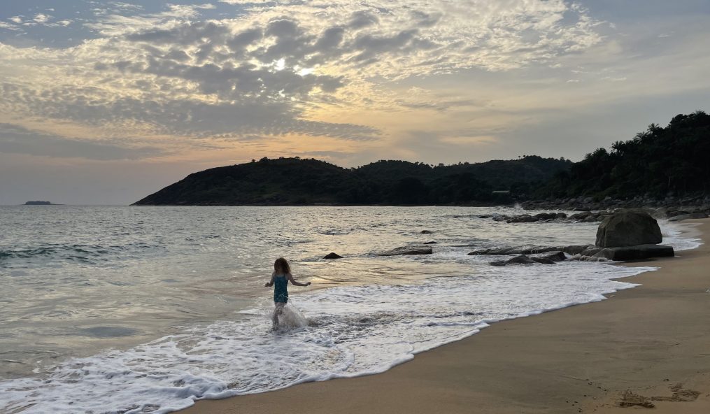
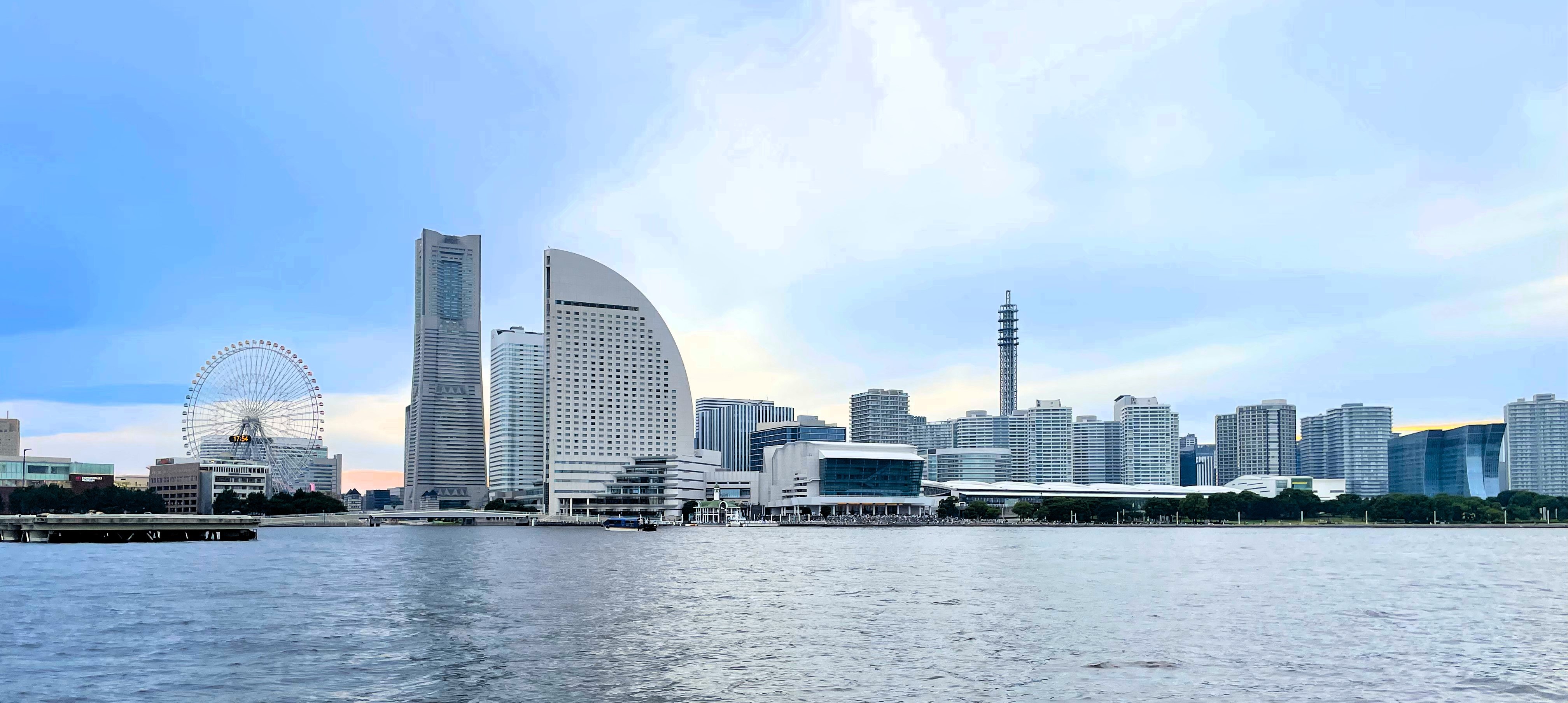
When I said that we – my daughter C and I and my friend CZ and her son Little CZ – were spending our entire two-week holiday all in Tokyo, I may have stretched the truth just a wee bit. We had this one-day trip to Yokohama. But given the size of Tokyo and the time it took us to get to those locations, Yokohama was for all intents and purposes basically Tokyo.
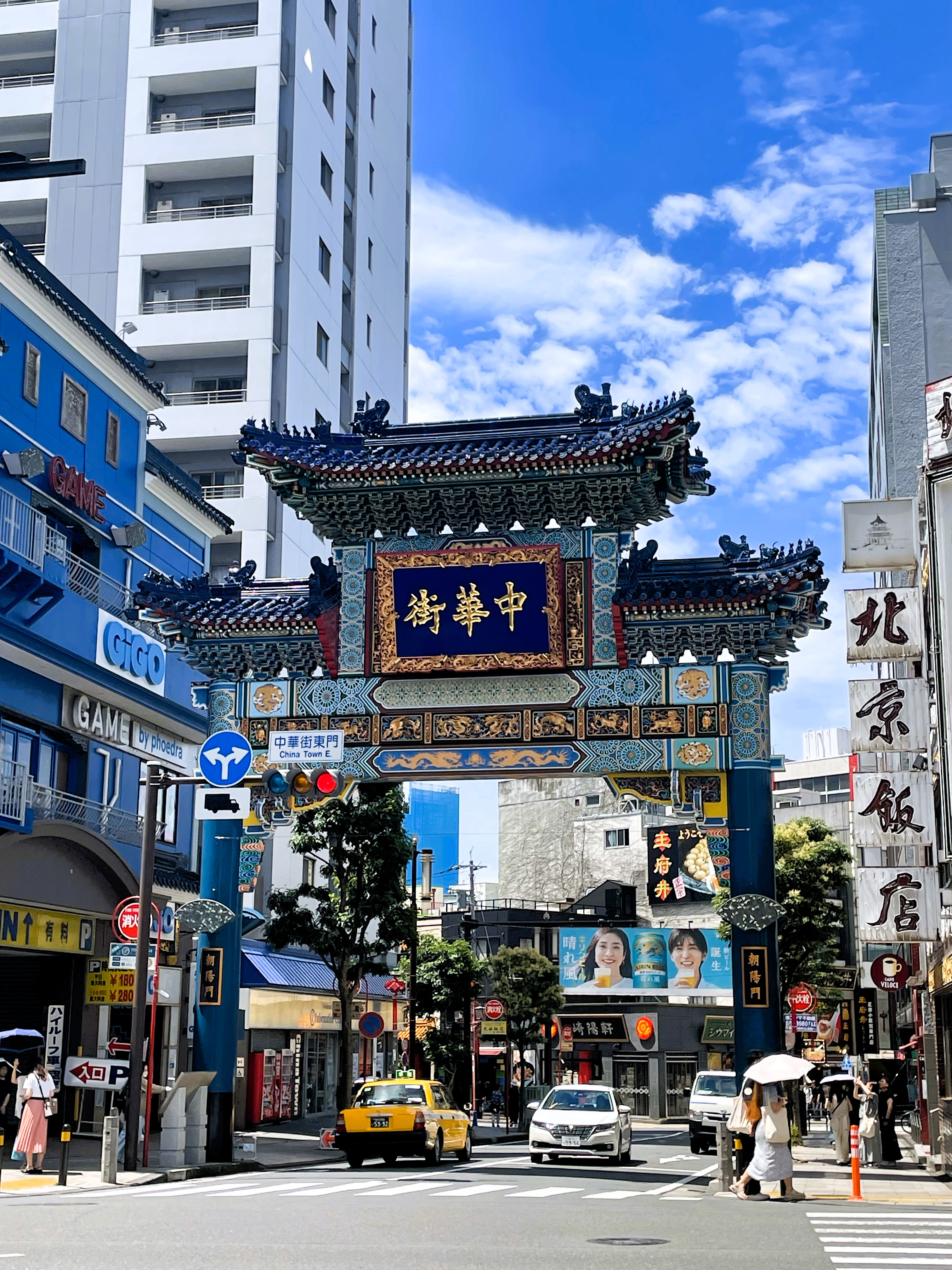
Yokohama Chinatown’s entrance gate
By now, our fourth day, I had pretty much decided C and I had miraculously avoided jet lag. And, spoil alert, thankfully we had. (And if I did not have witnesses to the fact that C and I did not face plant early in the day our first few days, I might not have believed it either!) The day was blazingly beautiful as we set off on the hour-long train journey. Our first stop was Yokohama’s Chinatown, the largest in Japan.
We weren’t one minute into Chinatown when C and Little CZ spotted a shop displaying tanghulu, the colorful sugar coated fruits on a stick, and by the time I came back from taking a photo of the gate from across the street, they were busy munching away. Afterwards, we made it maybe half a block before we were lured into a fantastic souvenir shop with three or four floors of beautifully displayed items. A good 45 minutes later and several thousands of yen lighter, we re-emerged onto the street. And almost immediately came upon more snacks that called out to us. Little CZ spotted a vendor hand-making Dragon’s Beard candy, a concoction consisting of a floury sugar thread wound together like a small skein of yarn often referred to as Chinese cotton candy but with a lighter, more nutty flavor. Of course we got some. Then the kids needed bubble tea and I found myself wooed by a jian zhu dousha bao or porcupine bun with red bean paste, a deep-fried steamed bun filled with sweet red beans. Sooooo good. We had woefully misjudged the time we would need to explore this area. Unfortunately, we had an appointment to keep, so we had a Chinese lunch (yes, we ate again) and made our way quickly to our next destination: the Cup Noodles Museum.
Yummy Chinese snacks: on the left the vendor showcases his dragon beard’s candy and on the right are my just-from-the-fryer-and-about-to-be-devoured porcupine buns.
I expect it might be at least a little weird that we planned our whole Yokohama trip around a visit to a museum dedicated to instant noodles. Or maybe not? After all, Japan is full of weird and wonderful things that attract many a local and tourist alike. Noodles are certainly not a Japan-only phenomena; in fact, the food court in the Cup of Noodles Museum is dedicated to the celebration of noodles from around the world, but ramen is a Japanese word that has stuck and instant noodles were invented in Japan. And my daughter might have a particular love for Japanese ramen, instant and otherwise. After all, she did name her cat Ramen…
First up, we had reserved a 90-minute “Chicken Ramen Factory” experience. The name sounds a bit silly, but it’s basically a noodle making class. We each donned a bright yellow chicken handkerchief on our heads, were instructed to wash our hands thoroughly, and were collected by our chicken ramen teachers to begin our foray into the wonderful world of chicken ramen.
Cup of Noodles Museum, Yokohama; left: clandestine photo of chicken ramen factory; right: a wall of instant noodles
For some reason, CZ and I were separated from C and Little CZ. Maybe it was because we were the last to roll into the noodle factory kitchen or maybe the noodle masters like splitting up foreign families? Or, as I mostly suspect, the guardians of the Cup of Noodles cooking operation realize that the foreign kiddos will get the techniques down much faster than their elders. It became fairly apparent soon into the process that the English-speaking noodle coach assigned to CZ and I found our skills wanting. She kept a smile on her face and a bright, chirpy voice, but kept repeating instructions like “Pound the dough more.” or “Turn the handle more faster….No, more faster.” At the next table over, our kids were routinely ahead of us. We were maybe not failing at Chicken Ramen Factory, but we were barely getting by. We also tried to take photos, not knowing this is apparently verboten, further disappointing our chicken ramen guru.
All in all it was a fun activity and our instructor’s frustration with our lack of chicken ramen talent (by her standards!), only made it more fun. At the end we were loaded up with our own handmade chicken ramen package, three other ramen packages, and we got to take home our bright yellow handkerchiefs.
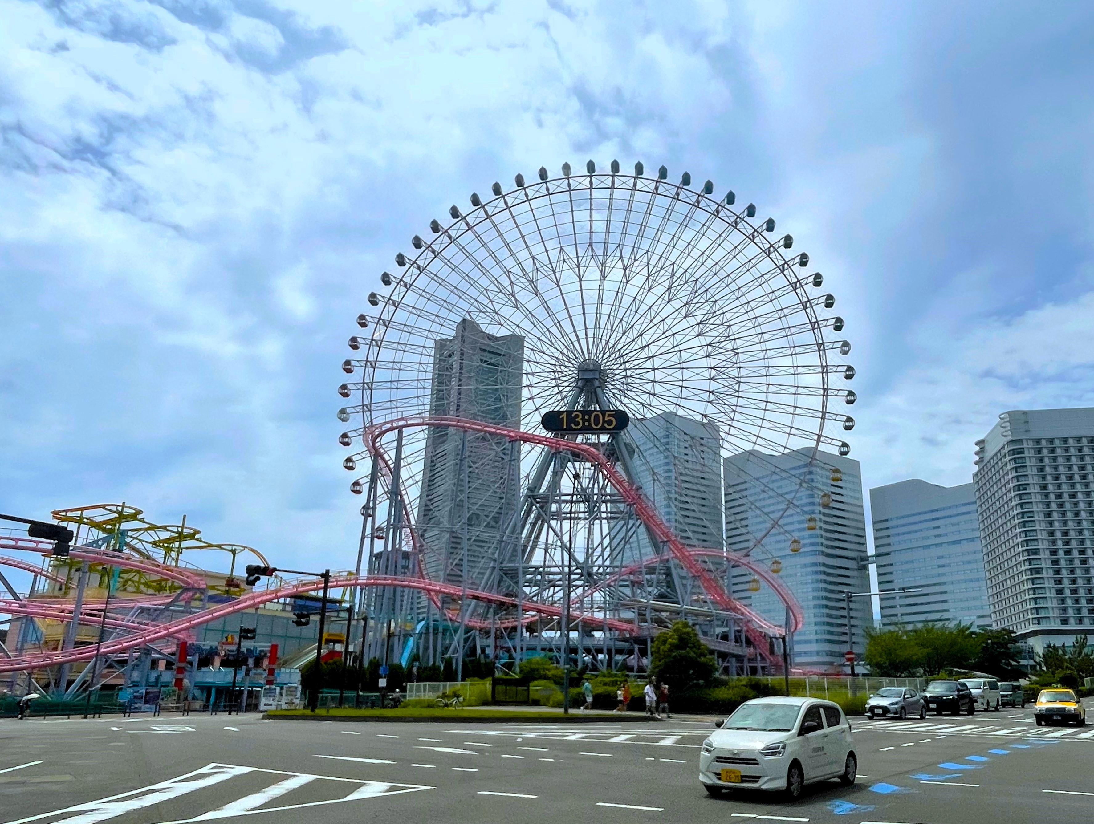
Yokohama Cosmo World
The rest of the museum was a bit of a letdown. It was designed rather like a modern art museum with cavernous rooms with little in them: an all-white plaster (?) rendering of a Cup of Noodles cup with an explosion of artistic white noodles hanging from the ceiling, for example. Still, it was enough for another 30 to 45 minutes before we emerged back on the street.
Across the street, Yokohama Cosmo World, a small amusement park with a giant ferris wheel beckoned to us. We had to check it out. Through attractive from a distance, we did not stay long. The ticket process was more complicated than it could have been: one had to buy paper tickets for each ride, much like what I remember from traveling carnivals in my youth, but we found some machines not working (or we couldn’t figure them out). In the end we road only the pink coaster and decided to pass on the wheel and the air cabin.
View of Yokohama from a water taxi in the bay
Instead of just walking to a train station to return to Tokyo, we opted for a 15-minute ride on the water taxi from Shinko Pier to Yokohama Station. In the Yokohama Bay Quarters shopping center we had dinner at Kua’aina, a Hawaiian burger joint, then took the train the hour back to Roppongi where we wrapped up our day with an hour of karaoke in our own private family room. Another successful day in Tokyo!
My daughter C and I were up around 5 AM on our second full day in Tokyo. Early, yes, but still far better than I expected so early in a trip half way around the world. I made sure C had some breakfast goodies from a nearby convenience store and I took an early morning of walk over to Tokyo Tower. I returned in good time and we met CZ and Little CZ at the Roppongi metro station where we hopped on a train to the Sumida district.
One of the several sumo wrestler statues on the street near the famous Kokugikan stadium in Sumida
We were heading there to take part in a lunch with sumo wrestlers at the Yokozuna Tonkatsu restaurant. The Sumida district is famous for sumo wrestling. Japan’s first sumo tournament was held here in 1768 and the stadium there continues to host three of the six Grand Sumo tournaments held each year. Many professional sumo wrestlers live and train in the area as well.
We had a little over an hour to kill before our lunch and wrestling show began at 11:00, so we walked up to the Kokugikan stadium, where the grand sumo tournaments take place. I was on the hunt for the sumo wrestler statues I had heard dotted the area. I wish I could say the walk was pleasant, but the temperature was quite warm and Sumida district exuded an almost-deserted feel on a Saturday morning, a sharp contrast from the hustle and bustle of Roppongi. The biggest bit of excitement was when I finally found the statues and when two young, but of course very large, sumo wrestlers came into a convenience store where we were buying drinks. Their presence caused a bit of a stir, not only with us but also the Japanese patrons, but they were not particularly friendly.
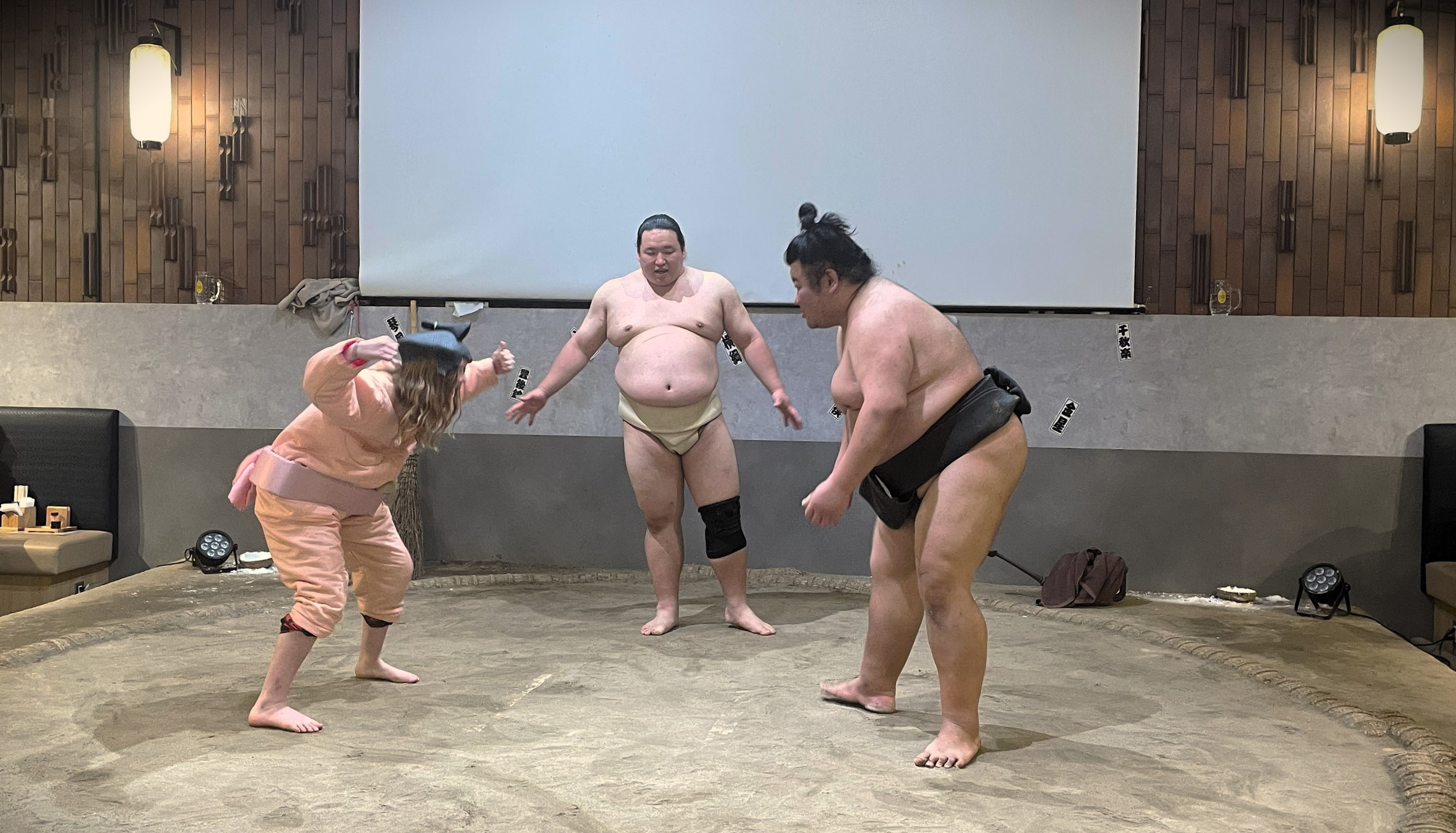
We arrived just in time for our sumo lunch. The food, a traditional tonkatsu or breaded fried pork cutlet, rice, and miso soup, was not particularly to our liking, but the fact that it is often served to sumo wrestlers and at this restaurant the meal is cooked by retired sumo wrestlers made it more special. However, it was the after lunch entertainment we were here for. During lunch, the restaurant showed a short film on sumo and then brought out two of their retired professional wrestlers to explain the key rules and procedures of the sport and give live demonstrations. Then, we the lunch-goers, had the opportunity to don hilarious suits and step into the ring. My hand shot up first, much to the amusement of my daughter and Little CZ. Following my triumphant (and silly) attempt, they also agreed to get into the ring. All in all, it was great fun.
The Sumida Hokusai Museum
We stopped next at the museum dedicated to Sumida Hokusai, the Edo-era ukiyo-e or woodblock print artist whose work “The Great Wave off Kanagawa” is one of the most recognizable paintings in the world. Hokusai was born in and lived the majority of his 90 years in the district that now takes his name. We spent about an hour here. Though both C and Little CZ were familiar with the famous Great Wave painting and found some interest in the comic-like woodblock prints of Hokusai and a few of the interactive displays, the museum involved far more reading and staring in wonder at art works than a 10 and 12 year old were prepared to give, especially with so much more to see in do in Tokyo awaiting them. Truth be told, the museum exhibits use up only two floors of the building and CZ and I were also ready to move on to more sightseeing.
The original plan had been for C and I to return to our hotel after the museum; I had been quite sure that by that time we would either be succumbing to jet lag or dangerously close to doing so. Yet again, surprisingly, we were not. With the Sunday weather forecast including rain, we decided to join CZ and Little CZ on a jaunt to preview some of Harajuku’s culture ahead of our planned visit the next day.
Left: Rainbow grilled cheese; Center: Entrance to Takeshita Street; Right: Plastic models of scrumptious crepes
We made a beeline to the most famous part of Harajuku, Takeshita Street, where we would find many of the wild, wonderful, and wacky parts of Japanese youth culture. C desperately wanted to check out the fashion stores and quickly disappeared into one, but we dragged her out soon enough to have some snacks. First up were some of Harajuku’s famous crepes that have been filling up customers on Takeshita Street since the 1970s. Unlike French crepes, the Japanese crepes are thinner, crispier, stuffed full of goodies like fresh fruit, whipped cream, syrup, and ice cream, and wrapped up like cones so they can be eaten on the go. Oh my were they good. We followed up the sweet with the savory, chowing down on some breaded rainbow cheese, which was just okay.
C in front of the Torii gate to Meiji Shrine and a selection of the sake barrels donated to Meiji
We then spent a good hour in one of the ubiquitous toy capsule stores spending coins like there was no tomorrow. CZ and I found it nearly as addictive as the kids! Then we meandered over to Meiji Jingu, one of the most important Shinto shrines in Tokyo. It is an oasis of green forest in the middle of the world’s most populous city; there are over 100,000 trees of some 230 varieties planted over 170 acres. I wanted some space, tranquility, and more muted colors after the crowded, color explosion of Harajuku. We spent maybe 20 minutes there, but after so many hours of walking, we opted to call it a day. I thought we might get back to Meiji again the following day, but alas, we did not.
It was rainy on Sunday morning. I had forgotten that June was Japan’s wettest month and in all the travel planning had failed to check this key bit of information. Having already covered some of Harajuku the day before though, we had the flexibility for a later start. Off we all went to Shibuya on the bus. We were already getting a good handle on Tokyo’s massive public transportation network and felt, rightly I think, pretty proud of it.
Great view of the Shibuya Scramble from the Starbucks
We first stopped at the famous statue of Hachiko, a real dog who waited faithfully each day outside of Shibuya Station even many years after his owner died. It is a beautiful story of loyalty and unconditional love that has made Hachiko one of the most famous dogs in the world, nearly 90 years after he passed away. We then made our way across to the Shibuya Scramble, the famous spot where seven roads converge and traffic lights signal for all pedestrians to cross at the same time. Though there are several vantage points to watch the crossing, we chose the Starbucks. The price of admission to the viewing windows was a green tea latte for myself and a cookie for C.
We leisurely made our way on foot back to Harajuku by way of another lost hour in a toy capsule store and a lovely ramen and tea lunch at a small mom and pop shop. Once again on Takeshita Street, we had a little time for window shopping and people gawking, before arriving at Harry’s Harajuku Terrace for our 2 PM appointment with the hedgehogs, chinchillas, and otters of this animal cafe.
There are many, many, MANY animal cafes to choose from in Tokyo. Initially, C had really wanted to visit a dog cafe with Shiba Inus, but we realized that was far too vanilla a choice from the options available. Should we see owls? Snakes? Fennec Foxes? As we were planning, I sent CZ a message of this particular cafe in Harajuku and within minutes of sending it she called. She didn’t even say hello, only “OTTERS!” And thus our decision was made. Though the hedgehogs were very cute, C and I had had our fair of experience with wild hedgehogs in Malawi, so they were not all that new for us. The chinchillas were adorable, but Harry’s limited the interaction with them. The otters were indeed the stars of the day. In our special interaction period with them (for an extra fee) they could not have given a fig about us; they just wanted their treats and we were merely in the way. But it was still a great experience.
Today’s purikura turned my daughter into an anime-like character
After Harry’s, CZ and Little CZ broke off for their own fun while I took my daughter C to the Purikura booths. “Purikura” is short for purinto kurabu (or “print club”), which are very popular photo booths where one can make all sorts of stylized photos. This is *not* the US version of the four poses, four printed photos booths. This is so, SO much more. Purikura had been a big activity when I lived in Japan in the late 1990s. Then though, you or you and a friend or a group of friends would have your photo printed on a variety of backgrounds to make mini stickers to share. Now, I found the photos and editing options are incredibly advanced. We struggled to figure out the process with the Japanese instructions, but C still had a fun time with it.
Dinner is served! My delicious hamburger steak with grilled miso cream cheese
Then we were off to meet my friend Koki, who had been my big’s big in my college’s co-ed service fraternity. Since college, Koki and I had met only one other time, around 1998, when I spent two weeks in Tokyo attempting to learn Japanese. Yet, I recognized him immediately. The three of us had dinner at Niku no Mori, a very small traditional counter service restaurant specializing in the very popular Japanese hamburger steak. It is more like an American meatloaf, usually cooked with onion, egg, and panko crumbs, and served over rice. Niku no Mori offered it also with a grilled miso coated slab of cream cheese.
I really enjoyed catching up with Koki over dinner and then he walked with us along Takeshita Street while C did a little Japan-style thrifting. We said goodnight to Koki at the train station and C and I returned to the hotel.
Day 3 in the books and still no real jet lag to speak of…
My view of Tokyo Tower on a glorious summer morning
A trip long time in the works
Right now travel to Japan is hot. Everyone and their brother and their third cousin twice removed has been making their way to the Land of the Rising Sun. The government closed the country to tourists for over two years during the COVID-19 pandemic, with individual travelers only being able to enter after 2 1/2 years. Thus a weak yen and people no longer wanting to put off their trip of a lifetime, Japan is now seeing record-breaking numbers of visitors.
Our trip though had been long in the making. I have wanted to take my daughter for many years. When she was in the first grade she did a presentation on Japan as the place she wanted to visit the most because, she said, the people there cared deeply about nature (this is the same kid who broke out in sobs during the class viewing of the great floating garbage patch in the Pacific Ocean). That same year C told her teacher she was part-Japanese so that could march in the school’s international parade with the small contingent of Japanese students.
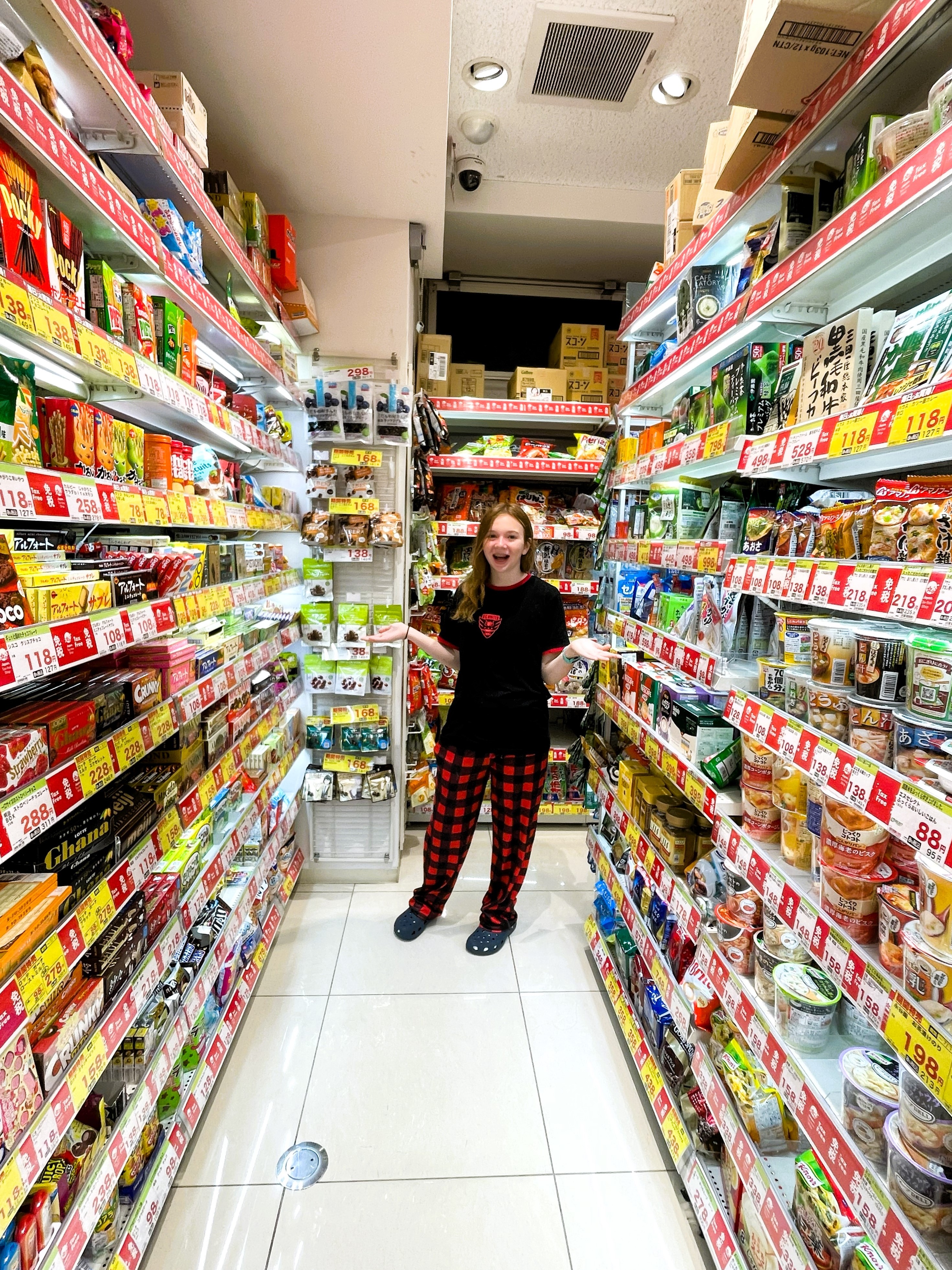
C in heaven in the Japanese snack aisle
C has loved Pokémon, anime, Nintendo, and Japanese snacks for several years, and now as a teenager is very keen on the fashion. She has wanted to go to Japan soooo bad. Also, we love Disney amusement parks and Tokyo was the final park for us to visit (after four times each to Florida and Shanghai, two times to Paris, two times to California, and one time to Hong Kong). And over 20 years ago I was an English teacher in Western Japan, and though we would not make it to my Japanese hometown, I still wanted to introduce my daughter to this country where I made so many memories.
I initially planned for us to visit while we were in Malawi, though the long distance and the complicated route were making me rethink it. Then the plan, for April 2020, was made impossible by the global pandemic.
Planning in advance, but not too far in advance
C and I would be traveling to Tokyo with our good friends CZ and her son Little CZ, with whom we have traveled together with in China, Paris, Finland, and on our London and Norway trip. After some discussion, we made the decision to only visit Tokyo as the mega-city offered ample cultural activities and sights to keep us plenty busy.
CZ and I are big travel planners; we really love it. For example, we have known we would go to Japan together in the summer of 2024 since sometime in 2022. We bought our plane tickets in the summer of 2023, as soon as the dates became available. We had our hotel in central Tokyo for the first part of the trip booked nine months out. And, we began to build our shared spreadsheet on places of interest about seven months out.
And then we were stymied because so much to see in Tokyo must be booked in advance, but not too far in advance. And it seemed every place has its own advance reservation rules. So many times we knew what we wanted to do, but we had to wait until the window of opportunity opened. This was a whole other level of planning detail that we had not been quite prepared for.
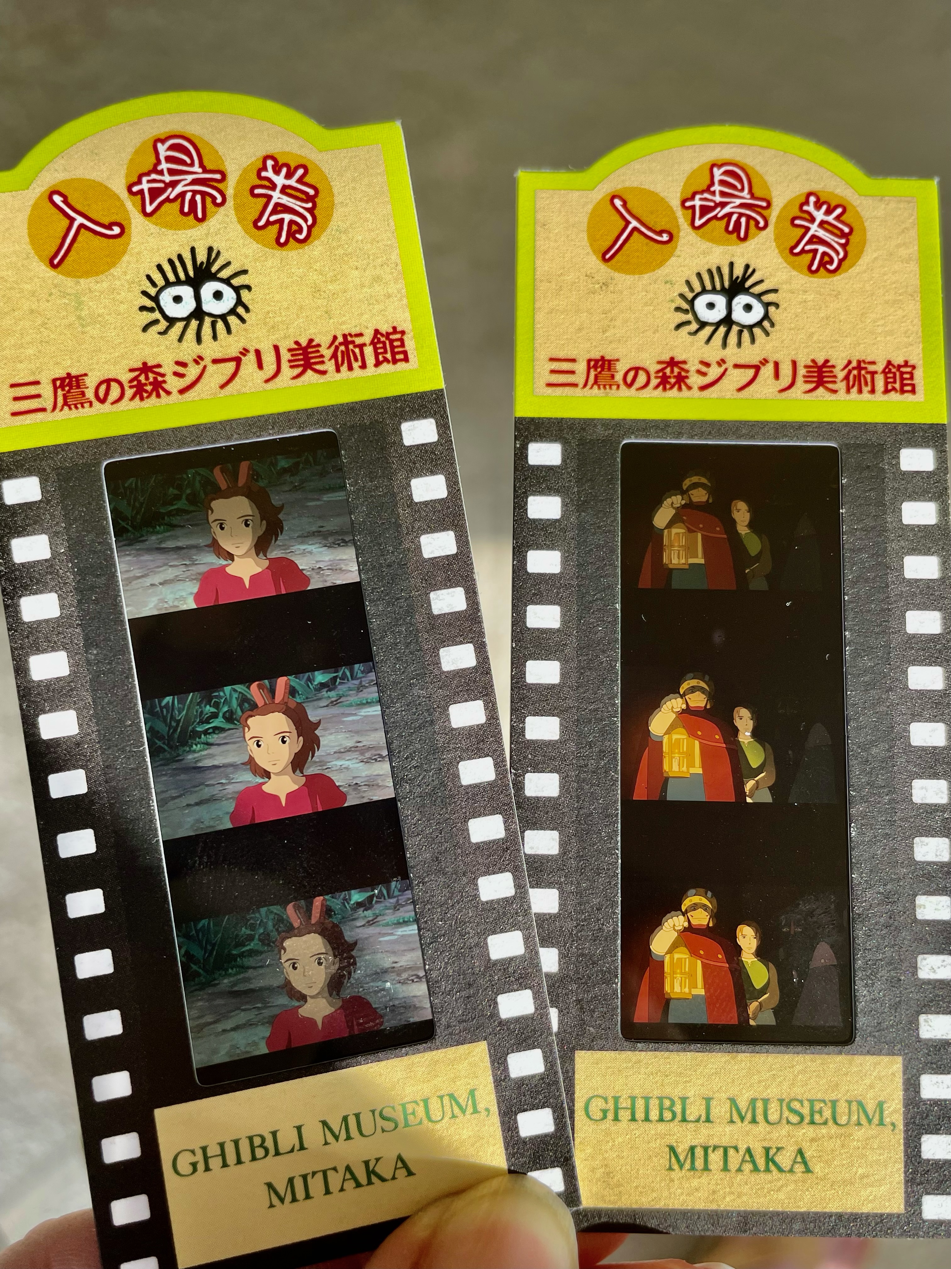
We were soooo lucky to score these unique film strip tickets to the Ghibli Museum!
Tokyo Disney hotels can be booked from 11 AM of the day four months before.
Tokyo Disney park tickets can be booked starting from 2 PM of the day two months ahead of your visit (and you cannot book multi day tickets or park hopper).
Imperial palace gardens tour can be booked from the first of the month preceding the month you want to visit.
Pokémon cafe – reservations are accepted from 6 PM 31 days out from desired visit date, but you need to be on the website at the moment reservations open and have a tremendous amount of luck.
Cup of Noodles Museum Yokohama – reservations can be made starting at 10 AM three months and one day prior to the day you wish to visit.
Toyusu Market Tuna Auction tour – is offered through an advance lottery system: to visit one has to apply for lottery the first seven days of the month preceding the month of your visit and only 100 people selected per day. (We got it!)
Ghibli museum – Visitors must have advance reservations, but one can only do so at 10 AM on the 10th of the month preceding the month of your visit. This was the most difficult of them all as there are only 200 tickets available in 4 entry times per day. CZ and I logged on to the website in advance.; at 15 minutes till the appointed hour, a countdown started on the website. At exactly 10 AM Tokyo time, we were brought into the virtual queue – CZ had about 2500 people in front of her and I had about 17,000!! It took about 15 minutes and CZ got in; she was booted out of her first attempt – probably sold out – but on her second attempt she got in and scored us our tickets!! It felt amazing! It felt like we had just one the lottery and I suppose in a way we did. (I waited and I got in at 10:58 and nearly all days were completely sold out, just an hour after tickets sales for the month went live!!)
Is your head about to explode? We thought ours might! Yet, against the odds, we lucked out time and again. Sadly, it did not work out for the notoriously difficult-to-get Pokémon Cafe. I set my alarm for 4:50 AM so I would be on at 6 PM 31 days in advance. I logged in and could see the tickets for my day were not yet available. I refreshed at 5 AM, and the site was immediately unavailable due to heavy usage. At 5:03 it cleared and every single entry for the day was already sold out! In three minutes.
The jet-lag busting plan and the first full day
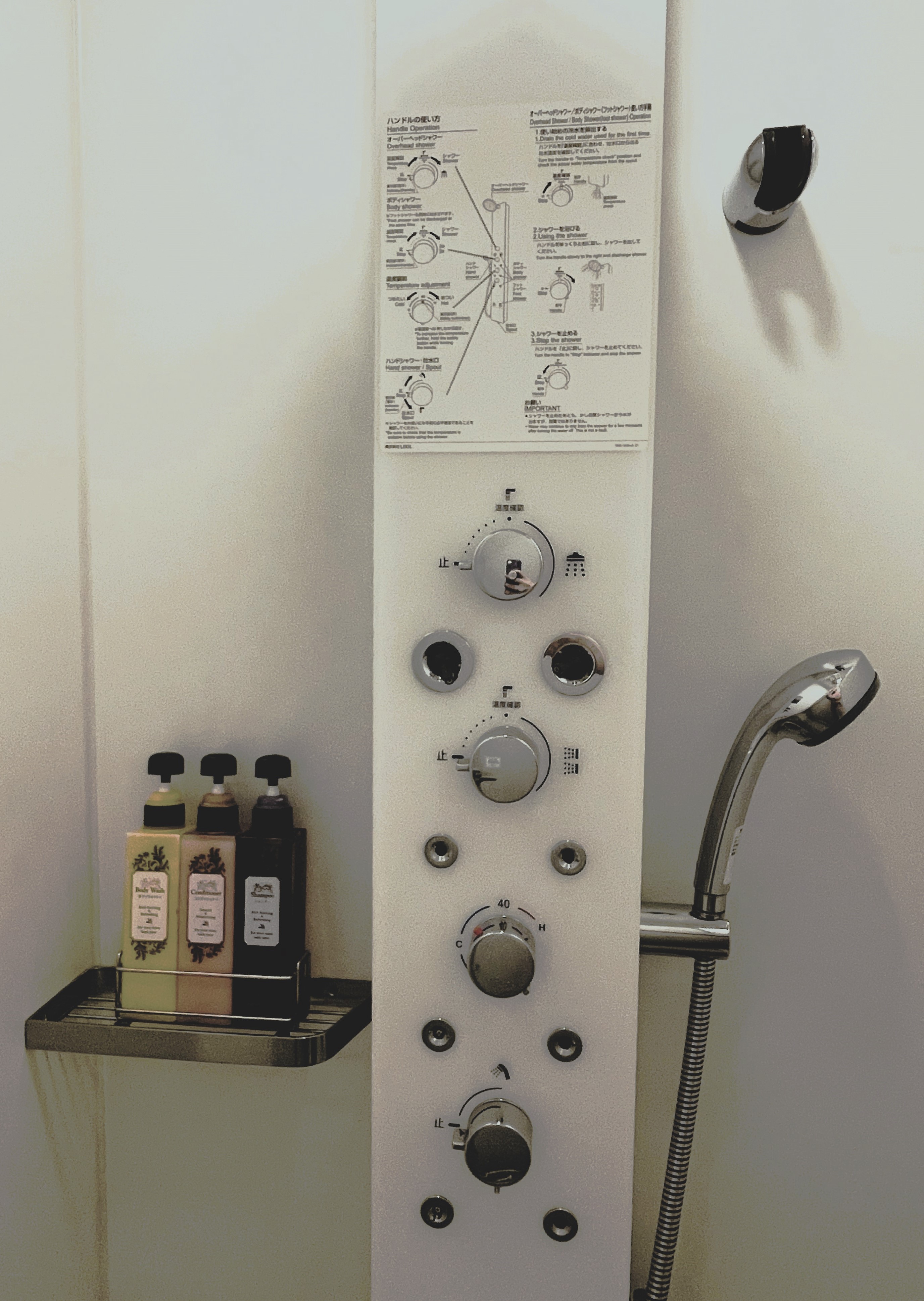
Jet-lagged and faced with this shower!
It had been a long time since we had made a flight as long as that to Japan, 14 hours from Dulles Airport to Haneda Airport. To combat jet lag, I had us in bed at a decent time the night before our flight and then we slept in as long as we could. As our flight took off around noon, the plan was to stay awake as long as possible, falling asleep only the last few hours. We would disembark bleary eyed and shuffle our way through immigration at 3:30 PM Tokyo-time, but the equivalent of 2:30 AM Eastern Standard Time. I hoped we would get to our hotel room around 5 PM where we could collapse and sleep as much as we could.
The first part worked out well, but the second part a bit too well. I did not sleep on the plane at all and C only slept for 1.5 hours. I worried we would be extra grumpy in the immigration line, but managed to get through the surprisingly poorly-designed immigration line. It seemed the airport was not quite prepared for the tsunami of visitors; it took us at least an hour. But we remained awake and in good spirits.
We did not fall asleep in the taxi ride to the hotel. Nor did we do so immediately in the hotel room. We had showers and went out to get some food from the closest convenience store. It was nearly 8 PM when I finally just turned out the light after 23 hours straight without any shut-eye.
I knew we would wake up in the early morning hours, but I thought it would be even earlier than it was; we made it to 3:50 AM. Luckily, our hotel was smack dab in the bustling area of Roppongi in the world’s largest city. There were, at a minimum, eight 24-hour convenience stores within a 6-minute walk from our hotel. We visited at least one each of 7-Eleven, Daily Yamazaki, Lawson, and Family Mart, checking out all the Japanese goodies, and buying snacks along the way. Once we had been out at least three hours we took our haul back to the hotel room for an eclectic breakfast.
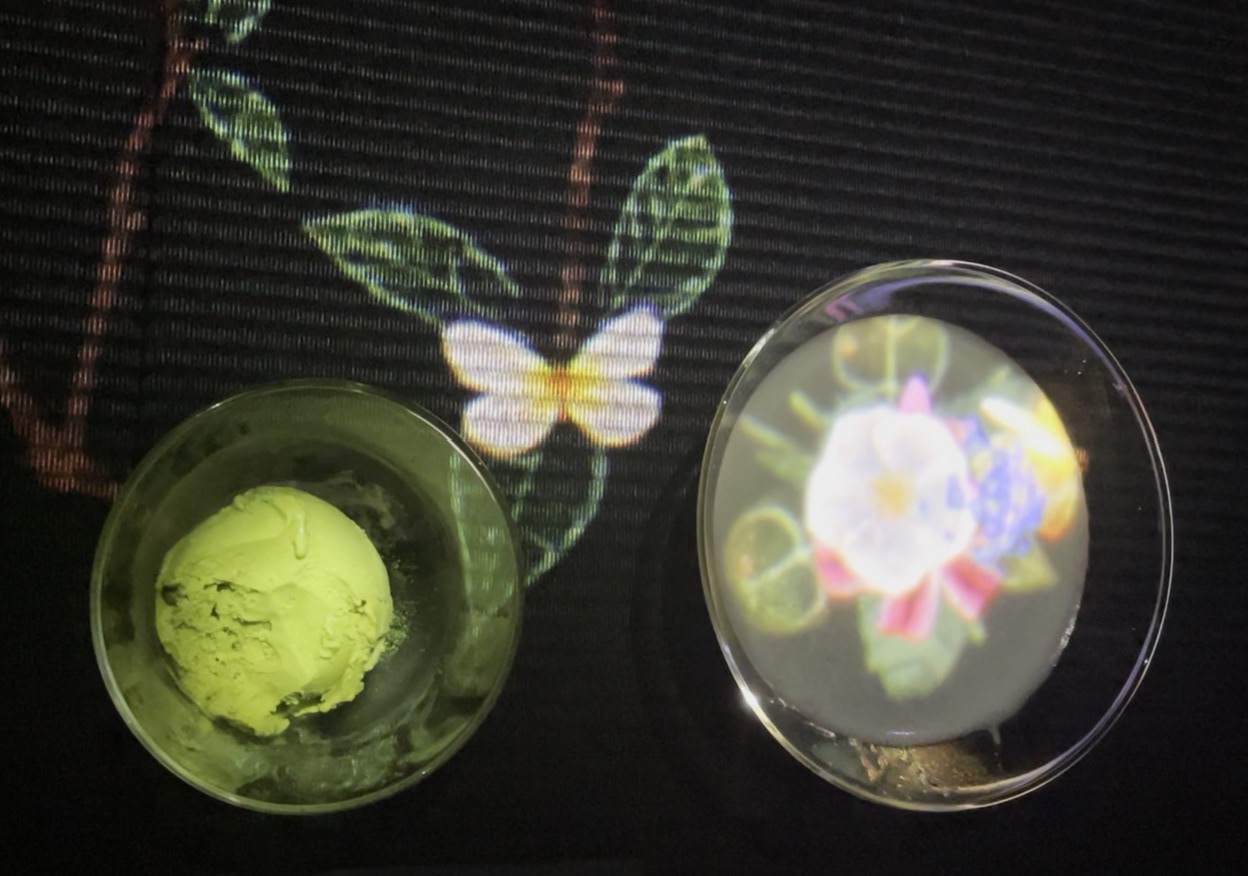
C’s digitally enhanced tea and matcha ice cream in the tea room of teamLab Borderless
Knowing we would have jet lag and expecting an early afternoon crash, we had only one thing planned for our first day. We met CZ and Little CZ at the teamLab Borderless digital art museum about 15 minutes from our hotel on foot. They had arrived in Tokyo a few days before us after a multi-stop journey to Dubai, Singapore, and Borneo, and thus were already adjusted to the time difference.
I find it hard to describe the teamLab installation; it really is something that must be experienced. A series of rooms with digital art projected on to the walls and spilling from room to room? The overflow from one room to another is why it is called “borderless.” Yet, this does not even begin to adequately describe the sensations of rooms large and small that defied my expectations. My favorite installations were: the Bubble Universe room filled with thousands of silver crystal orbs hanging from the ceiling that would light up at our proximity and the En Tea House which is so dimly lit that the colorful digital flowers that bloom from the tea or coconut matcha ice cream are even more vibrant as they spread out across the darkened liquid or black table top. We stayed in the museum for three hours.
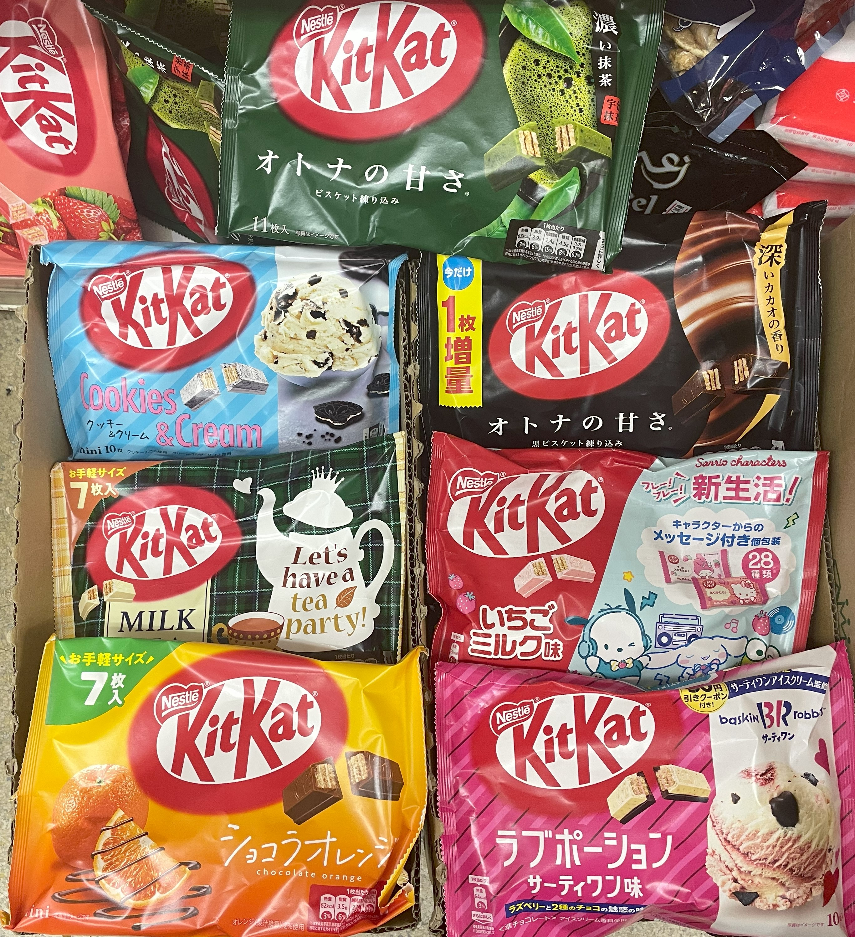
You can indulge your hankering for Japanese KitKat flavors at Don Quixote
We grabbed lunch at the nearby Hard Rock Cafe Tokyo (C and I have a tradition of visiting Hard Rocks around the world). I was sure that after lunch C and I would drag our jet-lag-fogged selves back to the hotel. But we were still awake! The magnificent 7-story, 24-hour operated Don Quixote store across the street called to us and we all heeded. We spent at least an hour, and a good chunk of change, exploring every floor.
C and I then parted ways from our friends. I figured we were going to give in to the jet-lag at any minute and would be best off at our hotel when it happened. I don’t know how we did it, but we made it to 7:30 PM! Surely, this could not last, right? We would find out on day two…
When I picked up my daughter from her overnight summer camp in Pennsylvania last year, I had driven through or near some sights that called to me to visit. This year I decided to make a weekend trip out of it.
I drove a little over two hours northwest of Washington, DC to the historic town of Cumberland, Maryland. Established in 1787 at the confluence of the Potomac River and Wills Creek and at the base of the Appalachian Mountains, the town has been at the heart of American history. Here, in the late 1750’s young army colonel George Washington led General Braddock’s operations in the French and Indian War and he returned in 1794 to review troops preparing to quell the Whisky Rebellion. Cumberland also gained fame in the 1800s as a transportation hub with the National Road (now US 40) began construction there in 1811 and in 1850 the Chesapeake and Ohio (C&O) Canal between Cumberland and Washington, D.C. opened.
History like that is my jam.
I picked the centrally-located (and historic!) Cumberland Inn and Spa as my base. I wanted to just park the car and then walk all over the historic district. I headed first a few streets up to the Gordon-Roberts House, once home to a prominent lawyer, statesman, and President of the C&O Canal. Unfortunately, the door was locked and I saw no one about. I tried knocking and called their phone number and left a message, but it seemed I had already struck out in the Queen City.
George Washington’s headquarters in Cumberland, MD
No worries, it was lunch time. So, I made my way down the street, passing the tiny building that served as Washington’s headquarters, and headed across the river. Baltimore Street is the main artery here and is flanked by beautiful buildings from Cumberland’s heyday. And the street completely torn up for a major renovation project that will turn it pedestrian only. It will be wonderful when it is completed, but wished my timing had been better. Still, I found a nice place for lunch and made the most of it. I did have wonderful weather!
After lunch, I visited Cumberland Station, built in 1913, from where still operates scenic steam and diesel train rides. I walked over to Mile 0, the terminus, of the 184.5 mile C&O canal; its towpath a popular multi-day ride for cycling enthusiasts. I will be honest here: the canal waters were a bit stagnant, some rubbish was floating in it; across the way some unhoused individuals crouched beneath a bridge, likely welcome shade from the strong, hot sun, and a festival featuring a death-metal band was in full swing (though the music was pretty good, it was not quite the soundtrack I expected). Yet, the sky was a blazing blue generously sprinkled with cumulus clouds and with just the right angle, the scene was perfect.
Mile 0 of the C&O Canal begins (or ends) in Cumberland
In the National Park visitor’s center I chatted with a young AmeriCorps volunteer eager to learn about how to parlay his education and experience into a career at the State Department. I was grateful my daughter was not with me; she is not a fan when I get too friendly and chatty with strangers. She would also have disliked my talking with the lovely volunteer docent at the Allegany Museum. Housed in two floors of a former 1930s courthouse and post office, it is packed full with interesting information, mostly on the architecture, industry, and transportation history of the region.
I left just before the 5 PM closing and planned only to walkabout the area looking at the architecture when my phone rang. A young woman asked if I had called earlier that day to visit the Gordon-Roberts House and told me that unfortunately they have few tours and it would be closed for a special event on Saturday. Well, I figured, that’s that. But then she said, “Well, I am here now doing preparations for the event…If you are nearby, I can give you a quick 15 minute spiel and then let you self-tour.”
The impressive Second Empire style Gordon-Roberts House
And that is how I ended up with an after hours tour at the house. I really could hardly believe my luck and the woman’s generosity. She gave me more than 15 minutes of her time and really did let me wander around on my own through the ground floor, second floor, and basement (the third floor is closed to the public – but I still took a peek). I found the house interesting – six bedrooms on the second floor alone! And a dumbwaiter! And a pre-electric single person elevator! – but by far the best part of the experience was that I got to tour it in the manner I did. I spent another hour or so of the long summer evening wandering past the churches, the Masonic Temple, and other architectural gems before calling it a night.
The LaVale Toll Gate house dating from 1835
On Saturday morning I set off for Somerset County, Pennsylvania along US40. At the Allegany Museum, I had learned that Maryland’s first (and last) toll house still stands just a few miles outside of Cumberland. It was on the way—just a slower, more picturesque way—so how could I resist?
The LaVale Toll Gate stands forlorn on the side of US40. Next door there was a Goodyear tire shop and across the street a gas station, both of which seemed rather fitting to me for a place where travelers have had to stop their journey for nearly 200 years. It was not open, there were no other cars in the parking lot and no other visitors while I was there, yet, I am glad it is still there for the odd traveler and history enthusiast.
The Barronvale Covered Bridge, built 1830
An hour later, I had a teary-eyed C and her belongings in the car. She had had a wonderful two weeks at camp and was thrilled to see me (imagine it!) but also sad to leave her new friends. I knew immediately what would cheer her up! A visit to an old covered bridge! Somerset County is full of them (ten in total) and I had pre-programmed directions to one of them as we headed to our next destination. I should have known better though (and really I did) because once at the bridge C opted to stay in the car (“I can see it from here.”). My free-wheeling, teenager-free part of the trip was over.
I drove east about 30 minutes to a field just outside Shanksville, PA, where on September 11, 2001, the brave passengers and crew of United Flight 93, learning their plane was part of a terrorist act, forced the hijackers to crash the plane, killing them all but saving hundreds, if not thousands, more.
Flight 93 National Memorial: view of the flight path from the Visitor’s Center (left), the Tower of Voices (center), and memorial wreaths at the far end of the Memorial Plaza
We started off with a walk down from the visitor’s center that passes the flight path, impact site, and wall of names. The weather was nice, warm, with clouds that threatened rain but held off; the field dotted with wild flowers. It felt both fitting and incongruous as a final resting place of such an act of terror. C was far more focused on a school issue than the site and I tried to refocus her attention on the importance of the location. We moved on to the Visitor’s Center and it was here, with the television footage of the planes flying into the towers, the photographs of the passengers and crew, and recordings of some of their final goodbyes that left us both weeping. We completed our visit at the Tower of Voices, a ninety-three foot tall structure of wind chimes that plays 40 tones representing the voices of the 40 passengers at their final resting place.
Our next stop, after a quick lunch stop: the Johnstown Flood National Memorial. Along the way, I thought, though certainly educational, perhaps two national disaster memorials in one day might not have been my brightest idea?
The valley that once was Lake Conemaugh
The Visitor’s Center sits on a hill overlooking a valley, what what was once the two mile long, one mile wide, and 60-feet deep Lake Conemaugh, before on May 31, 1889, the earthen dam holding it burst releasing 20 million tons of water downriver at 40 miles per hour, wiping out the town of Johnstown and killing over 2200 people within an hour. Reading that sentence is sobering enough. Looking at the photographs and reading or listening to first hand accounts of survivors was more so. But the 35-minute movie “Black Friday” shown at the Visitor’s Center? Wow. It is seriously a downer. It so vividly describes the horror and the fatalities that it comes with a PG rating with a recommendation that small children do not attend. I began to worry a bit about C. When she was six, she sobbed through her school viewing of a movie on the Pacific garbage patch, and when she was seven she cried out loudly “No! Stop!” when colonists attacked Native Americans at the production of “The Lost Colony” at Roanoke Island, NC and then bawling yelled “Mom! Why would you bring me here?” But thankfully at 12 1/2 she could handle this particular film though I found myself cringing several times.
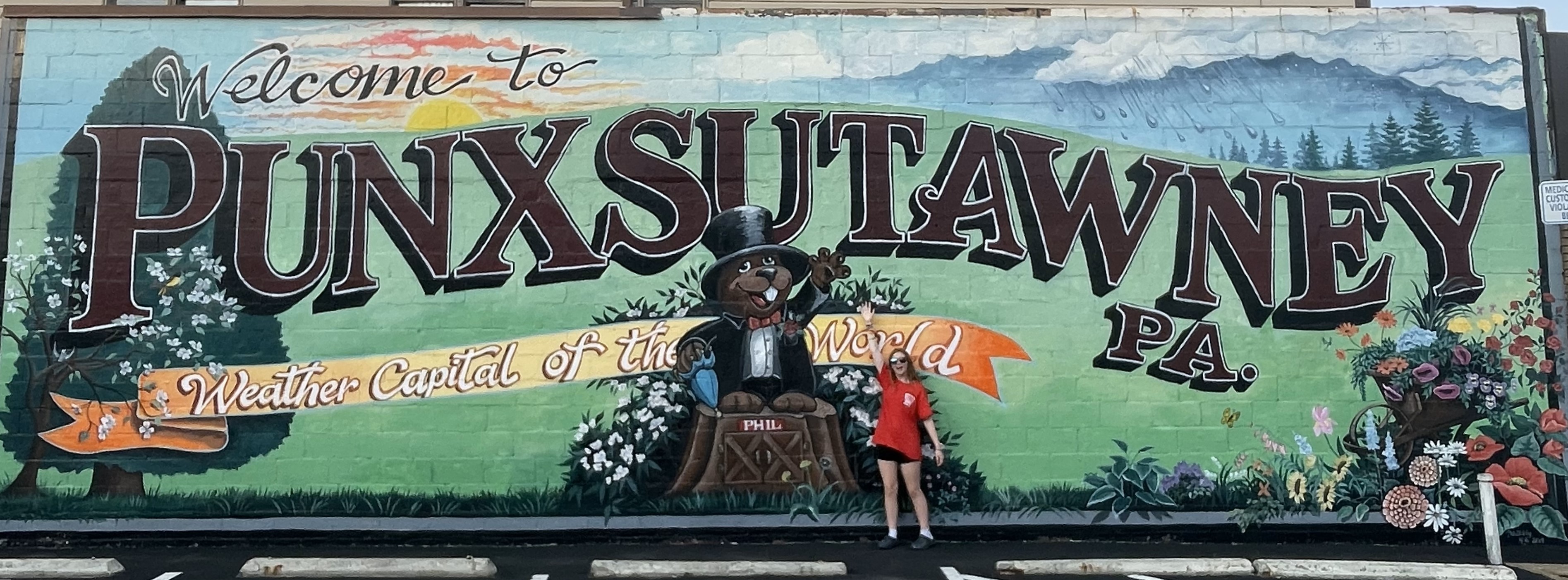
To round out our day and bring the mood up, I turned north to Punxsutawney, Pennsylvania, “the weather capital of the world,” and home to the famous spring forecaster Punxsutawney Phil. Although the movie “Groundhog Day” (one of my personal favorites), was actually filmed in Illinois (yeah, really), I did find us a lovely B&B just on the main town square that was close enough for me. We were just a hop, skip, and a jump from Phil’s Burrow, the home of Punxsutawney Phil, his spouse Phyllis, and their kit. After visiting Phil, whom C declared as adorable before asking if she could have a pet groundhog, we went for a nice evening walk in search of the Phantastic Phils, the six foot tall fiberglass groundhog statues placed around town.
One of the 40-something Phantastic Phils and C hamming it up at Gobbler’s Knob
On Sunday morning, C and I made the pilgrimage to Gobbler’s Knob where each on Groundhog’s Day since 1887, Punxsutawney Phil, “Seer of Seers, Sage of Sages, Prognosticator of Prognosticators and Weather Prophet Extraordinary,” is coaxed from a tree stump and held up before the eager crowds then makes his prediction of the coming Spring. I doubt we will ever make it for an actual Groundhog’s Day (accommodation books out years in advance and one has to wake up in the dead of night in the middle of winter; me I am not a fan of the cold or middle of the night galivanting), so this would have to do. We chased down the locations of a few more Phantastic Phils and then it was time to go. C’s dad picked her up for a week in New York and I headed home.
I don’t know why it continues to amaze me how restorative even a few days away can be, but throw in beautiful weather, lovely drives, and historical, natural, and cultural sites, and it can truly be perfect.
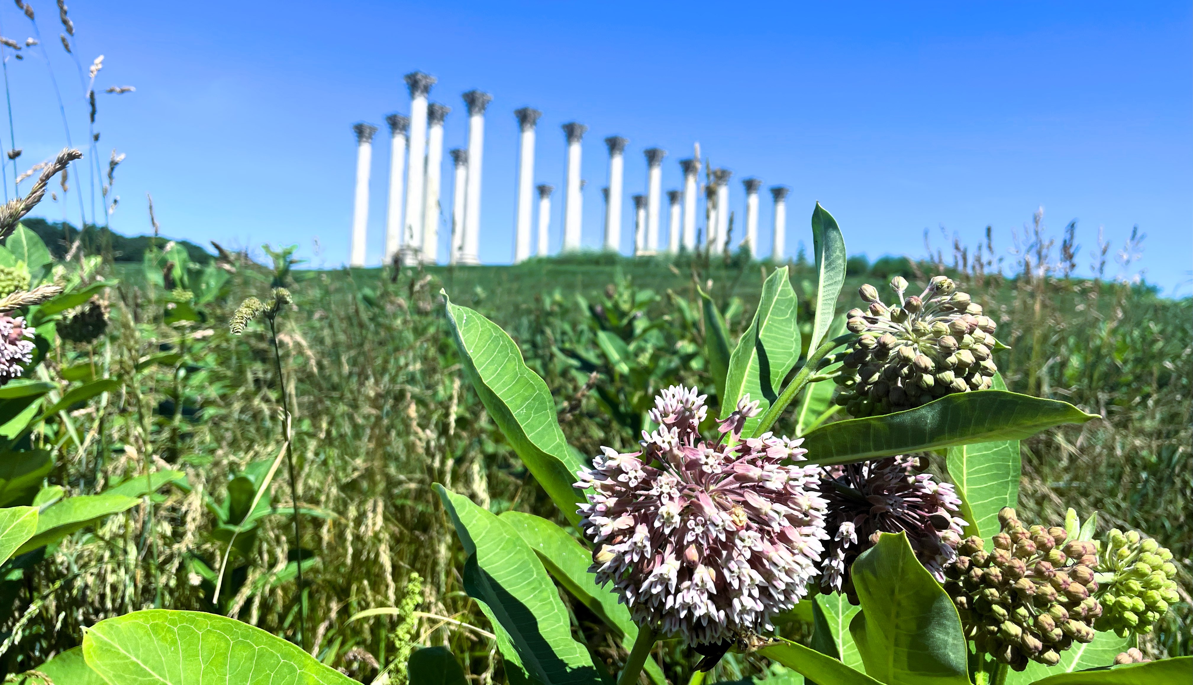
The National Capitol Columns at the National Arboretum
As we come up on a year and a half back in the United States, C and I are embracing living close to Washington, D.C. As I grew up and spent some of my early 30s in the area, there are places I long planned to visit, but put off doing so, figuring I would do so eventually. But then I spent so many years away, and the places I had put off until “someday” did not become a reality. Until now. By shifting my mindset to seeing Washington, D.C. as an assignment, I feel more inclined to get out and about while we are here.
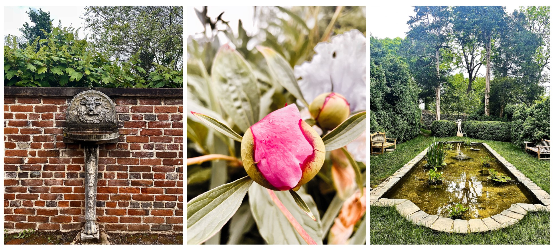
I had big plans for May, unfortunately, Mother Nature had other ideas. It seemed as if the old adage “April showers brings May flowers” had been reversed. We had an April of glorious weather, then May began with lower temps, overcast skies, and scattered showers. The first weekend was a washout, so I was especially keen to do something the second weekend. We headed to the Oatlands Historic House and Gardens located in Leesburg, Virginia, about 45 miles outside of D.C. I had fond memories of Oatlands; my parents have photos of me there as a baby, my mom took me as an older child, and I am sure there was a school fieldtrip there at some point. I really wanted to take my daughter there.
Sights around the historic Oatlands garden
Fortune though was not on my side. The mansion, built in 1803 and listed as a national historic landmark, was undergoing renovations; the scaffolding made even exterior photos unattractive. We had tickets to self-tour the garden and it was still pretty beneath the overcast sky, but then my plans to stroll the grounds afterward were foiled by the cooler than expected weather. We cut our losses and went to lunch.
Strawberries galore at Wegmeyer Farm’s Leesburg location
Luckily, the sky cleared and the temperatures warmed for our next activity – picking strawberries at the Wegmeyer Farms plot just down the road from Oatlands. I had a vague memory of strawberry picking when I was a young child, and I really wanted to do it with my daughter C. It was not quite what I had been expecting; I thought there would be a farm, maybe some attractive buildings or fences, something, but it was just rows of strawberry plants. We were handed a bucket and told to stay in one assigned row for the picking. Still, we did have fun and the strawberries were delicious.
The following weekend C had a Scout camping trip so I had hoped to do some sightseeing on my own, but the weather did not cooperate. Therefore, we planned to make the most of Memorial Day weekend. On Friday evening, we had the great pleasure of seeing my sister and nephew grace the stage in a community production of Anastasia. The show was fantastic and it was incredibly fun to see our family members take part. This is something we really missed out on when hundreds of miles away overseas.
On Saturday, C and I visited the Clara Barton National Historic Site in Glen Echo, Maryland. After we had both been to Antietam, where Clara Barton ministered to wounded on the battlefield, this made a good follow-on visit. The site preserves the home where Ms. Barton spent the last years of her life and also an early headquarters of the American Red Cross, which she founded. We were able to take a very good National Park Service (NPS) ranger-led tour that covered the first floor of the home, but unfortunately, the floor was bare of any furnishings and the upper floors were off limits due to upcoming renovations.
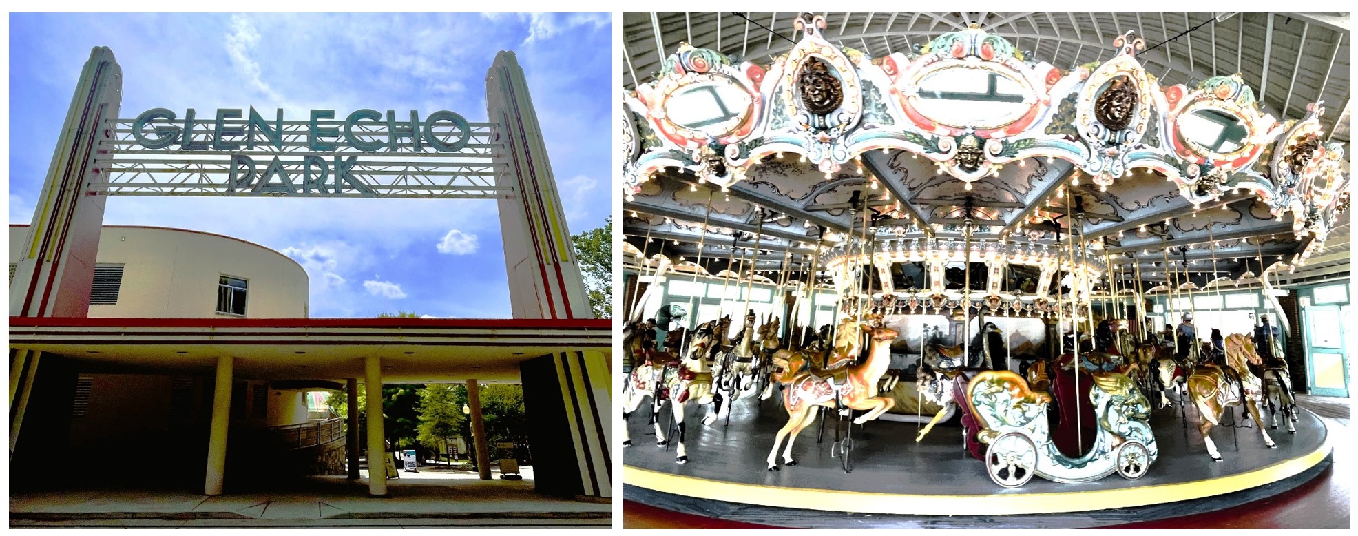
No worries, I thought, the Clara Barton site sits next door to another NPS-run Glen Echo Park. The park started first as an educational institute for adults called the Chautauqua in 1891. From 1911 to 1968, the site served as an area amusement park and was a site of civil rights protests in the latter years. It became a NPS-managed site in 1971 and then a place for arts and cultural performances in 2001, coming nearly full circle from the Chautauqua days. C and I though were primarily there for the 1921 Dentzel menagerie carousel, a National Historic Register site in its own right. C and I have long been a fan of historic carousels (or maybe it is mostly me; see also here and here). We did ride the carousel twice; we would have gone a third time except the carousel operator gave a very generous 20 or so times around each go, which was almost too much of a good thing. We walked a bit more around the park, but we found it sadly underutilized.
Jefferson did not have to contend with warning signs and prohibitions – he could just get right up on that rock
On Sunday, C and I headed to Harpers Ferry, West Virginia with friends. I absolutely love Harpers Ferry; its preserved history and attractive location at the confluence of the Shenandoah and Potomac Rivers just 65 miles from DC, make it a great place to visit on a beautiful weekend. And it is another NPS-managed site. With 6 kids in total, my friends and I walked the 1.6 miles from the main parking to the lower town. It was another lovely day, warm, but not hot, and the trail through the trees and then alongside the road was pleasant. We visited several key sites in the town to include John Brown’s fort and the industry museum, walked across the bridge over the Potomac River to Maryland and back, up to Jefferson’s Rock, where our third president Thomas Jefferson reportedly stood in October 1783, had lunch, and, of course, got some ice cream.
We rounded out our month-and-then-some of getting out and about with our first professional soccer match when we went to see DC United play against Toronto at the six-year old Audi Field. C and I have been to the nearby Nationals Stadium for baseball games at least a handful of times, but had never seen a live soccer match before. Our seats afforded us a great view of the goal line and several corner kicks and the thrilling penalty kick by DC United that tied up the game. I expect we will see more games in the future!
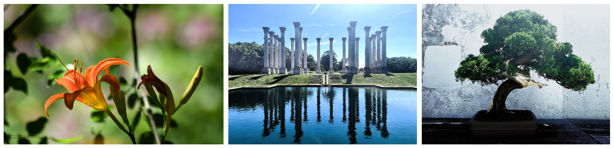
Finally, I dragged C to the National Arboretum in D.C. for some walking and photography. It’s another site in the area I had long heard of and wanted to visit and at long last got around to. The highlight of the National Arboretum are the Capitol Columns, 22 Corinthian columns which were part of the United States Capitol building from 1828 to 1958, which now stand arranged in a meadow alongside a reflecting pool. It is a popular spot for photographers, walkers, and picnickers. I managed to walk a bit with C along a pretty trail near the columns, again in the Asian collection, and then the National Bonsai Museum, but she protested any further exploration for the day.
Sites at the National Arboretum – at the Asian collection, the Capitol Columns, and a bonsai tree
I continue to be grateful to be here in the DC area, where we have such opportunities for recreation and excursions practically in our backyard or within a day’s drive. It is a great reminder that travel need not involve many hours on an airplane.
April is usually the real beginning of spring in Washington, D.C. This April also marked 15 months since our abrupt departure from Guinea and just a little over a year since we moved into our permanent apartment in the northern Virginia area. It was that last marker that feels the most significant. While my daughter C and I have been in and out of the northern Virginia area many times for training, some shorter, some longer, this April signaled a real milestone: the longest we had been in one place in the United States. For my daughter, it would be the longest in her 12 years. For me, the longest since 2008.
There are times when it feels strange indeed. To be a U.S. Foreign Service Officer who is not overseas. Of course, many U.S. FSOs work at headquarters in D.C. It is just the first time I am doing so, and I am still trying to wrap my head around it at times.
I decided I should be taking more advantage of the area with all of the history, culture, and nature close by and within just a few hours drive.
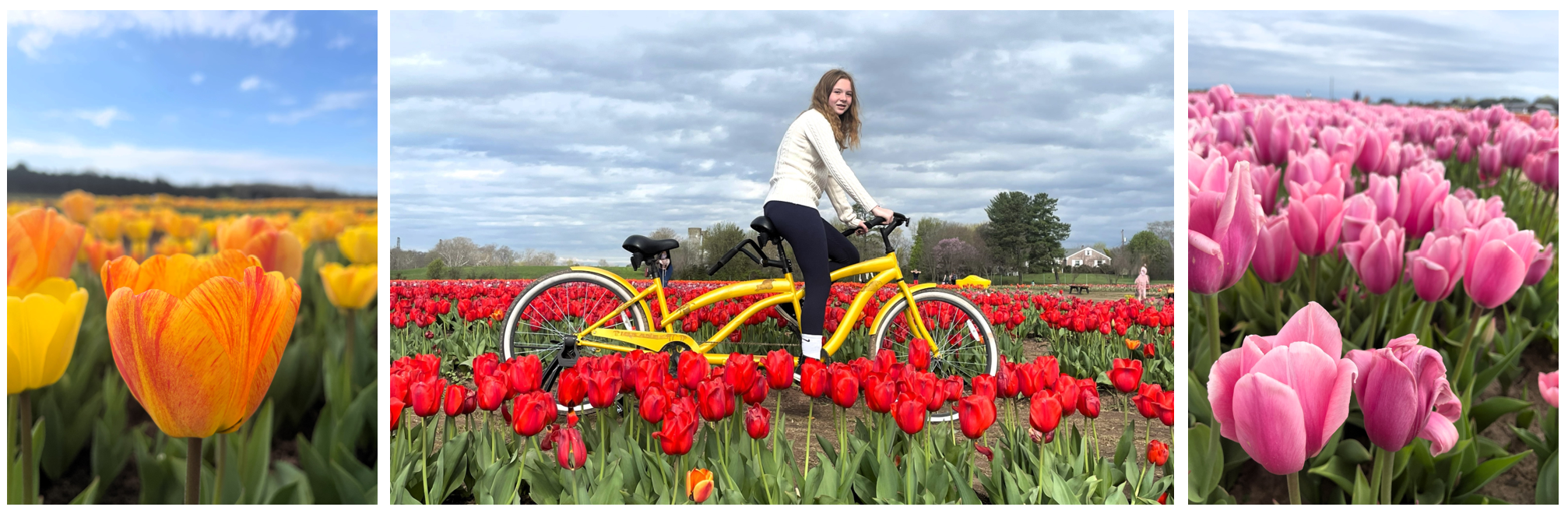
A sea of multi-colored tulips at Burnside Farms
Our first stop this month was the Burnside Farms’ Festival of Spring. I first heard about it last spring, but had not been quick enough to get tickets before it sold out. Yet for the first time in a long time in America, I could tell myself, well, there is always next year! Lucky for us, this year my daughter had a day off school scheduled in the middle of the festival and Wednesday morning tickets were much easier to come by. And when I found out a friend of mine was in town from Nicaragua for training and had brought her son along, we took her son with us to see the flowers. Rain was in the forecast, but again we lucked out; it was partly cloudy at first and then blazing blue skies.
I have long wanted to see the tulip blooms in the Netherlands. I have been to the country twice, but both times were in July, far too late to see the tulip fields. Burnside Farm’s spring festival was a nice substitute.
High and fast waters churn over Great Falls
The following Monday, C again had school off. I took her and her friend visiting from Nicaragua to Great Falls National Park for a short hike. With our annual National Park pass bought for our visits to Joshua Tree and Death Valley last December, we could visit Great Falls for no additional fees. It is extraordinary to me that these falls on the Potomac River and the protected wilds around them lie just 17 miles outside our nation’s capital. So close, and yet a world away. I came here a few times as a kid, with my mom and sisters I am sure, possibly with school groups. I came here again with C’s dad when she was a baby. We visited here when we were back from Malawi to hike with friend’s from there. C and her friend seemed to have a good time — the falls were cool of course, but there also seemed me to be a lot of Pokemon in the area they could catch with Pokemon Go… Well, sigh, they were still in nature.
The War Correspondents Memorial Arch
The next weekend, C and her Scouting troop had a two-day camping and bicycling at the Antietam National Battlefield, just outside of Sharpsburg, Maryland. I had often thought of visiting Antietam. Even once, maybe fifteen years ago (?), I drove to the entrance gates and grabbed a brochure intending to get out there sometime soon. I opted then to volunteer to drive my daughter and other Scouts to and from the campsite, but spend two nights in a nearby hotel doing some sightseeing on my own. I promised my daughter that should I see her at Antietam, I would pretend not to know her.
Getting C into Scouting has been one of the highlights of being in the U.S. The Antietam trip would be her fourth camping trip in the six months since she joined. I have been so impressed with all the skills, camaraderie, and confidence she has gained. And I loved the idea of us both seeing the same place around the same time, but in different ways.
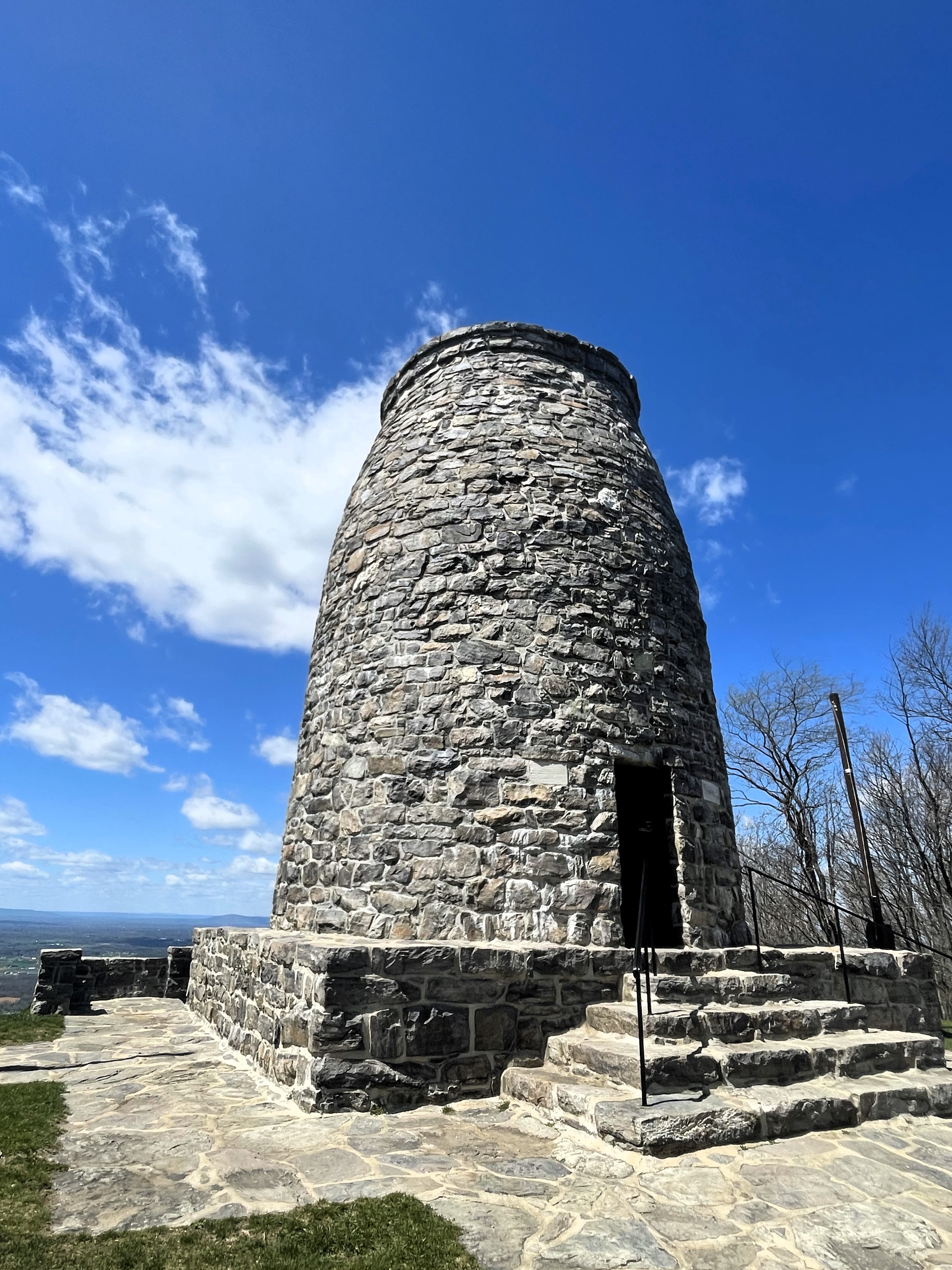
Unlike C, who was camping at Antietam and traveling by bicycle, I had a car and decided to make the most of my day on my own. It turned out to be a day full of American history. I first headed to George Washington Monument State Park, just outside of Boonsboro, Maryland. Along the way, I drove through Gapland and stopped at the site of the War Correspondents Memorial Arch, built by George Townsend in 1896. Townsend worked as a Civil War correspondent in his early 20s and at just age 24 became famous for his articles on the Lincoln assassination. Outside of Boonsboro, I made my way to the site of the nation’s first monument to our first president. The squat 40-foot tall stone tower was reportedly built by the townsfolk of Boonsboro in a matter of days in 1827, twenty-one years before construction began on the more famous monument in Washington, D.C.
Though the temperatures were a comfortable warm and the skies a dazzling blue, the wind was high, especially atop South Mountain, and it whipped around the monument making it difficult to stay long to enjoy the view. And time was of the essence; I just had the one day to make the most of it.
On my way to Antietam, I made a quick stop at the Kennedy Farm, the location where for three months abolitionist John Brown and his fighters planned and practiced their doomed raid on Harper’s Ferry. Though part of the National Park Service, I was the only person there at the time. There are no park rangers or staff on the site; there is just a small lockbox just inside the door where visitors can leave a donation. Given its importance, I had expected more. But I suppose it is enough that it is preserved.
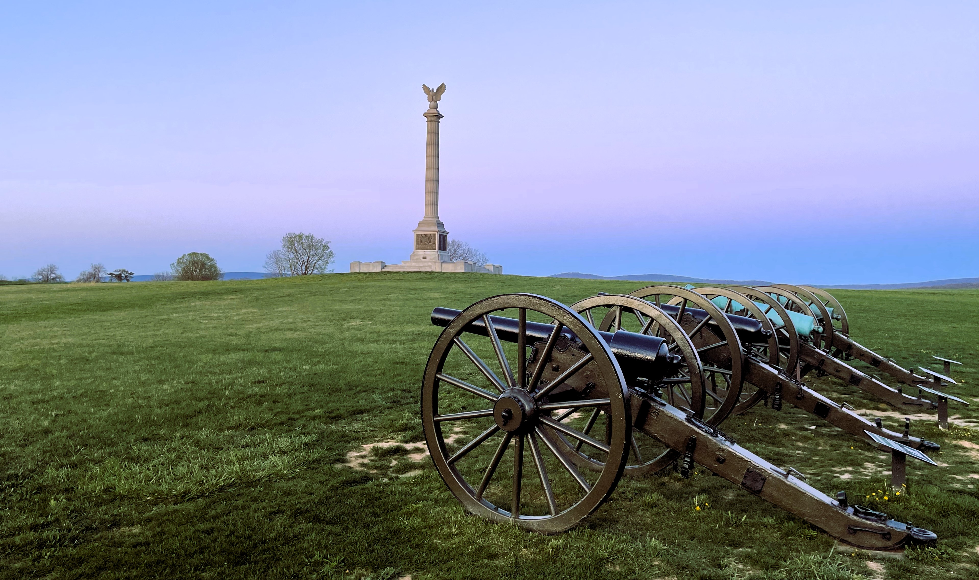
I made sure to return to Antietam as the sun was setting to experience it without the crowds and capture a sunset photo
Then it was on to Antietam, where I spent the rest of the day, some walking, some driving. I never did run into C or her troop, though we talked about their visit on the hour and a half drive home the next day. We talked about the Potomac River, which we had just seen the frothing at Great Falls a few weeks before, to where General Robert E. Lee had crossed into the North, and the river as it passed near the battlefield. We talked of the significance of Antietam, the U.S.’ bloodiest single day in American military history, from the first battlefield photography to the role of Clara Barton, who would go on to found the American Red Cross. It is important to me that while we are in the U.S., that my daughter, who has spent thus far the majority of her life overseas, gets to experience the conveniences of our country but also is exposed to our history.
Fast moving small falls heading to the Great ones
C and I wrapped up our April 2024 local sightseeing with a trip to the portion of the Chesapeake and Ohio (C&O) Canal National Historical Park on the Maryland side of the Potomac, across from Great Falls I remember as a kid wanting to visit this spot (and for some reason I was desperate to ride a canal boat through the old locks), but only recall us ever visiting Great Falls on the Virginia side. With C spending so much more time outdoors with the Scouts and her love of scrambling over boulders after our trip to Joshua Tree, I figured we were up for a hike along the Billy Goat Trail.
We were blessed with yet another incredibly gorgeous day, perfect for a hike by the falls. While there were a good number of other folks on the trail, it was not what I would call crowded, so it had just the right amount of hiking without a lot of waiting or noise from other hikers without the “oh my goodness, I haven’t seen another person in an hour, I hope I am not lost forever” feeling. We saw a good amount of wildlife from a black snake to a great blue heron and frogs to geese, had a wonderful workout, and some great mother-daughter time.
C surveys the Potomac River front an overlook on the Billy Goat Trail
All-in-all it was a great month for activities around our area. And while this might seem to some not to be the most exotic of blog post destinations, especially considering the locations we have traveled to, for us, who have spent so much time outside the country, the ease in planning and executing visits to such places and the variety of places to go and things to do, is not something I want to take for granted. In the majority of places where we lived, we had only a fraction of these sorts of things to do. We are looking forward to seeing more!
Late last September, with the summer firmly over and our Christmas train trip arranged, I turned my eyes to planning our spring break getaway.
I knew I wanted to be somewhere warm, but also someplace not too taxing or far from home, so I zeroed in on the Caribbean. We would have only a week for the Spring Break / Easter week and early on the airfares and mile redemptions for the week were a disappointment to say the least. (Perhaps prices will never return to pre-COVID levels? It sure feels like it.) Honduras looked to be a good choice and initially, I had planned on time in both the Bay Islands and on the mainland, but quickly realized that to secure a lower airfare and a less stressful holiday, it would be best to shorten the holiday and just stay in one place.
I am glad I kept it simple. Early in 2024, my mom ended up in the hospital and I became the primary point of contact for calls with various medical staff, case managers, and more. With the daily medical discussions and issues that could take from one to six hours, I began to contemplate canceling our trip altogether. In the end, I got her treatment to a certain point where I felt I could split the difference such that I would still have some much-needed rest and relaxation and mother-daughter time, while also making daily check-ins related to my mom’s care. It was far from ideal, but I believe it was a good compromise.
Roatan from the air–demonstrating some of the reef system surrounding the island
Roatan is a fascinating place. It’s history, which includes a visit by Christopher Columbus, serving as a hangout for infamous pirates like Blackbeard, and once being a British colony, has shaped Roatan differently than the Honduran mainland. Although the British ceded the Bay Islands, including Roatan, to Honduras in 1861, it took nearly a hundred years before Spanish was taught on the islands’ schools. Today, English is still the first language of the islanders.
Roatan is a popular tourist destination for nature and adventure activities. It’s location along the world’s second largest barrier reef, the Mesoamerican, makes it an extremely popular scuba diving site. Roatan also boasts two cruise ship terminals, the first opening in 2008 and the second two years later. For an island only 40 miles long and 5 miles wide and a population somewhere between 50,000-100,000 people, two cruise ship terminals disgorging some 3,000 to 10,000 passengers a day in high season is astonishing. All these North American travelers have made the U.S. dollar the currency of choice on Roatan, vice the Honduran lempira.
The pineapple seller heads home
I knew none of this. I usually research the heck out of where I am going. I like to know the history and current situation; I like to know the language, currency, and exchange rate. But this time, with all the stuff going on with my mom, I left much up to chance. I booked our flights, reserved our hotel, and looked up, but did not schedule, a thing for us to do.
On Sunday morning, C and I celebrated Easter a week early and then that night flew to Houston. We stayed the night then flew on to Roatan early Monday morning, arriving at our hotel, the Bananarama Dive and Beach Resort in West Bay, in time for a hectic lunch rush during a steamy tropical beach day. Ahhhhh…it felt amazing to be warm.
I struggle with stepping back and doing little. I like to keep engaged. But here it was our first day on the island and I had nothing at all planned. I had not even booked transport from the airport to West Bay. It only occurred to me as we boarded our plane in Houston that it could be a problem. Luckily I quickly checked the interwebs, reserved and paid for a taxi, and hoped for the best. I really thought it was 50-50 anyone would actually come and figured I might have just thrown $25 away. I was pleasantly surprised to find a driver with a cute handwritten sign with my name waiting for us in arrivals!
C holds Charlie the Sloth
Therefore on our first day, all C and I did was make reservations for some activities on following days, walk on the beach, checked out the nearby shopping plazas, and lie about in the hammock or chairs on our bungalow porch.
On our second day, we headed to Jungle Top Adventures for an exciting few hours of ziplining and animal interactions. There seem an abnormally high ratio of zipline locations per population on Roatan, due to all those cruises. When we booked the zipline, we were not told which we were heading to, and I was a tad disappointed to find ours was located in Coxen Hole, the island’s main town, directly across from one of ports where two massive cruise ships were docked.
As I had read it is best to visit the animal park first because the sloths — the main attraction — can only be held by a limited number of persons before they are too tired, that was our first stop. While we did enjoy seeing to coati and the Yucatan white-tailed deer (Honduras’ national mammal) and meeting the monkeys and macaws, the sloths were the star of the show and one of the top reasons we chose to visit Roatan. C and I were both able to hold a sloth for about five minutes. With their arms around our necks and their legs around our waist, it was almost like holding a baby. The experience did not disappoint.
Next we headed to the zipline. We had to wait about 10 minutes before we could join the truck taking participants to the first of 16 zipline platforms. While the guides kitted us up, two more truckloads of adventurers arrived. All in all we had to wait 30 minutes before all our zipline guides arrived and zipped off to man the various platforms. However, once everyone had their gear and the guides were in place, we were zipped across the lines rapidly, like an assembly line. I had hoped to get a photo or video of my daughter, but she was hooked up and then off with such speed I hardly had time to react before it was my turn. When I arrived at the platform, C was already zipping on to the next. At the midway point though we all crowded together again. This time I was able to video C taking a running leap off the platform and then flipping upside down — of all the ziplines I have done in various places this was the first and only place I had heard of that being allowed.
C and I and our group prepare for our submersible scooter experience
On Wednesday, we did the most extraordinary activity! We glided through the water in a Breathing Observation Submersible Scooter (BOSS). I had initially booked for Friday, but the company emailed me on Tuesday afternoon to inform me that Thursday and Friday were predicted to be poor weather, but they could accommodate us earlier.
I have to admit, I was a wee bit scared to do this. I enjoy being warm and near the water; to feel sand between my toes, but I am not comfortable in the ocean. I get sea sick on boats. I am not comfortable in the ocean. I once tried to learn to scuba dive in the Philippines and kept freaking out during the basic water practice. I am just much more a landlubber and I get most of my fish experiences at aquariums (which I LOVE to visit). But C was excited to give it a try and so I thought I should be brave and give it a go.
The scooters work on the principle of an air pocket forming in a glass underwater. To get in, the scooters are held just below the water’s surface with the air pocket already formed in the large diving bell-like helmet. Then compressed air, just like the tanks used for diving, is pumped into the helmet. One has to hold one’s breath for just a few seconds to duck under and bring their head into the helmet. Well, it sounds simple. C did it in one go. I freaked out. It took me five times to get up the courage to get in. Thankfully, C went first and did not see that. Once everyone is in, the scooters are lowered to their maximum depth of ten feet. Then one can controls the scooter just like a scooter on land — with a toggle switch for speed and moving the handle bars to the sides to turn.
We visited the Roatan Chocolate Factory in West End after our underwater scooter experience
I wear glasses and unlike in snorkeling, where I have to accept blurred vision because I am not going to spring for a prescription mask, I could wear my glasses while operating the underwater scooter! I also have a lot of ear and sinus issues and that (along with a fear of sharks and running out of air and drowning) is what keeps keep from scuba diving. At the depth of the scooters, I could feel the pressure on my ears and I struggled to pop them, having to do so repeatedly, but I could manage. I have never been able to see a reef and fish underwater like I could on the scooter and I found myself laughing with delight. Also, because the giant helmets made everyone’s heads look really tiny on top of their bodies.
Thursday and the first part of Friday did turn out to have poor weather. Though it did not rain during the day, the winds picked up substantially, up to 25 mph, making the seas very choppy. Nearly all activity stopped along the beach. Though West Bay is a nice beach, it is not very wide, and on sunny days the beach chairs take up a good third to half of the sandy real estate and the crowds of beachgoers take up most of the rest. So though it was very breezy, it was still nice and warm, and I took strolls along the shore, while C chilled out in our hammock. I welcomed the respite. If the weather had been perfect, I would have felt compelled to be doing something, but as it wasn’t, I was off the hook. I did have to make several phone calls and emails related to my mom and I had time to do them, while also feeling sand between my toes and a deliciously warm wind all around.
The wind kicks up the waves around the water taxi pier in West Bay
The sun returned on Saturday, our last day, so C and I headed out to parasail. This would be C’s first time ever and my second, but my first time parasail in tandem. During my first time, in the Bay of Islands, New Zealand, the boat motor stopped when the woman after me was up, and her parachute slowly sunk back down to the ocean. She had to unfasten herself and swim back to the boat. I had thanked my lucky stars it had not been me, but admit that I had been a little scared to parasail since. I am happy to report that C and I did it without a single incident.
That afternoon C wanted to stand-up paddleboard (SUP). It had been on our list for the trip in a large part because our hotel had advertised it as being readily available. And yet throughout the week we had not seen anyone paddleboarding. When I went to ask at our activity kiosk I was told they didn’t have any paddleboards, and then the guy corrected it to, um, no paddleboards that work well. I really wondered about their secret defective paddleboards. At the next kiosk they told me they could get me paddleboards, but could they have ten minutes to “find” them? Turned out they could only locate one, so I left it to C to show me how it is done.
C looks pretty cool doing SUP at sunset
Unfortunately, C had only done SUP once before – at the lake during last summer’s camp. Doing it in the ocean on a busy beach turned out to be a whole new level. Still she managed pretty well. She took a little break after 15 minutes and let me give it a try. I only made it to a crouching position before falling off and struggled to maneuver around the crowds of bobbing heads. It became clear pretty quickly why SUP seems to have fallen by the wayside in Roatan, at least during the busy season.
Then just like that our six days in Roatan was over. Afterwards, once we returned home, it felt short, but during the trip it felt just right. It gave me just the right amount of time to rest, deal with issues at home, and spend mother-daughter time with C while doing amazing activities or just chilling out together.
The Washington Monument from the fountain at the WWII Memorial
This post is long overdue. One could even say it has become OBE or Overcome By Events in State Department parlance. And yet I cannot quite shake the thought of putting pen to paper in an attempt to explain at least some of the processes we went through to unexpectedly curtail from an overseas tour to Washington, D.C. To explain what is largely a bureaucratic logistical exercise based on policies and procedures laid out in the State Department’s Foreign Affairs Manual but can become exasperating and stressful.
Moving the Cats from Guinea In a Hurry. Traveling internationally with pets has never been without its challenges. {see here and here and here for example] On airplanes, my cats have traveled cargo, excess baggage, and in-cabin, but also in the car when we drove across the U.S.-Mexican border to Ciudad Juarez. Transportation though is just one piece of the puzzle. The greater challenge is the @%$&! paperwork. It has to be done quickly and correctly in a short timeframe within the 3-7 days of travel. Before going to Guinea, Europe had instituted new rules that required all pets transiting the EU to meet the same requirements as if they were entering those countries. Though we needed an extra document endorsed by the United States Department of Agriculture / Animal and Plant Health Inspection Service (USDA-APHIS) for the plane change in Brussels, that was all given that our travel originated in the U.S. However, coming from Guinea, designated as a high-risk rabies country, one needs to have a titer test completed at least three months before travel. This would not be possible with my shortened departure timeline. Therefore, we could not fly to the U.S. through Europe. Instead, we took Ethiopian Airlines via Addis Ababa, which required us to fly nine hours in the opposite direction first, subjecting ourselves to 34 hours of travel time door to door. And the cats to 34 hours in their carriers. This included Ramen, our new diplo-kitty. It was stressful, as usual, but we managed, again.
Temporary Lodging. When transferring from an overseas posting to the U.S., a Foreign Service employee can utilize the Home Service Transfer Allowance or HSTA. It helps employees and their families to defray costs upon their return. It can cover lodging and some per diem for up to 60 days, with some possibilities to extend should household goods not yet arrive. This gave C and I a place to stay while I worked out my next steps.
Before our arrival, I had reached out to the same company that provides temporary lodging for government workers that had housed us the year before. I wanted us to be in the same apartment building we had lived in during my French training as I figured it would provide the easiest post-curtailment landing for my daughter. I did not know where we might be after the temporary lodging, but at least I could initially ensure she would be somewhere familiar and would start at the same elementary school she had been at before we went to Guinea. We move so frequently in the Foreign Service that living in a place more than once is a rarity. Not only were we able to get the same building, but when we checked in we found we had been assigned the exact same apartment we had vacated only 7 months before! Alas, the HSTA covers for only so long and I needed to find something more permanent.
Enrolling the Kiddo in School. Once we moved to Guinea, I thought I was done doing the school enrollment for a few years. Yet here we were suddenly back in northern Virginia. Luckily, I had been through the process once before when preparing for my Guinea assignment at the Foreign Service Institute in Arlington, and the schools in the area are very familiar with military and foreign service families moving in and out of the area. Thus the paperwork was pretty straightforward. One thing I could not do in advance though was the tuberculosis test, which is mandatory for enrollment. Though our Health Unit at the Embassy in Guinea could perform the test before departure, a test conducted while still in a country with a high incidence rate of TB will not be accepted.
It had taken longer to arrange the curtailment than expected – with bureaucracy it is always a waiting game – and thus our flight got us back to the U.S. after school had been in session for a week after winter break. To get my daughter C enrolled as quickly as possible, the TB test was a top priority. After landing, we went through immigration, gathered our belongings, got a taxi to the hotel, and then with my father’s car waiting at the hotel, we headed straight to a clinic to get that blood draw. C was then able to start school a few days into the following school week.
[Not so fun fact: Later screenings found that my daughter has latent TB, most likely as a result of our serving in Guinea. The majority of persons with latent TB in the U.S. acquired it overseas. She had to undergo long-term monitored treatment for it. Just one more gift from Guinea and an unexpected side-effect to our lifestyle.]
The Search for Permanent Housing. As a Foreign Service Officer, there is not really any housing that is permanent until one leaves the service, thus permanent housing refers to the lodging one lives in for the majority of the tour. Overseas that is one’s assigned housing. In the U.S., it is the housing the employee finds to live in.
With my 4 years of college living in dormitories, my 7 years living overseas with various study, work, and travel, and the combined 14 years overseas with the government, I have not had a whole lot of experience looking for housing. Though I had found a remote assignment and could have lived anywhere, like my condo in Florida, I felt that 1. professionally it would be better for me to be in DC, and 2. personally it would be better for my daughter to be where she had been before. When I took her to school the first day back, a friend of hers from the year before spotted her, ran toward her, and they hugged while spinning around as if they were in a movie. I knew then that staying in the DC area would be 1000% the right decision.
However, knowing you want to be in a certain area and finding housing there are two very different things. House hunting is exhausting. There is research into what one is looking for and then checking out what is actually available on the market. Then setting up viewings. Each place has positives and negatives and I imagine C and I living in each one. In many ways, it feels similar to the bidding process we go through to get our next assignments. Then one finds a place and has to apply and hope the other side likes you too.
Thankfully, I absolutely lucked out and the fourth place we look at is a gem and the owner likes us and picks us over the other potential renters. Then, because I have lived in furnished places for decades, I had to buy furniture. I had odds and ends such as a rocking chair, a decorative bench, two wood storage cabinets, a piano, and many wall hangings, but I did not own a sofa or a bed, end tables or a TV stand, dressers or desks, bookcases or lamps. I expect that seems odd for someone my age, but it must be fairly common among those with this kind of nomadic life, right? Even though I tried to buy economical pieces, all the expenses did add up. Still, there was a bit of fun to the shopping spree.
After all that, it is little wonder that I was not very keen to pull up stakes again only six to 12 months later and decided instead to remain in DC. Every move just comes with so many challenges; it never seems to get easier. It might indeed be getting harder the older I and my daughter become. Yet there are many positives to being here and C and I look forward to spending some more time here before we head back overseas. Now that the mechanics of settling in have given way to feelings of being settled.
On the road in Death Valley heading toward Panamint Springs
On our second morning in Death Valley, we woke early in preparation for our departure from the park. I knew I would want more time in the park, so I reserved a hotel halfway back to Los Angeles instead of making the full drive that day. We would backtrack first, heading toward Death Valley Junction to visit Dante’s View.
Dante’s View, considered one of the best views in Death Valley, sits atop Coffin Peak and 5,575 feet above Badwater Basin, and provides an amazing panoramic view of the southwest part of the park. It allows one to see both the lowest area of the park (Badwater) and the highest; the 11,049-foot Telescope Peak sits on the opposite mountain ridge. Apparently, the early visitors to the area from the borax companies found the view evoked visions of Dante’s nine circles of hell. I cannot imagine what they were thinking given the spectacular beauty of the scene laid before us. From the height we could really see the size of the temporary lake in the basin below. The view is somewhat famous as it appears briefly in the first Star Wars movie as Luke, Obi-Wan Kenobi, C3P0, and R2-D2 get their first view of Mos Eisley. There was certainly no water visible at that time.
Our view from Dante’s Peak
From Dante’s View we would drive about two hours over the majority of Route 190, past Panamint Springs, to the Father Crowley Overlook. It felt further and longer. Though the park was busy, there were times when we saw few other cars. The height of the mountains towering over the valley, the sheer expanse of the seemingly barren wilderness emphasized how very small we are. Maybe it was in part due to these feelings that when we at last arrived at the Overlook, we found it rather disappointing. The steep and narrow Rainbow Canyon, where fighter jets from the China Lake Naval Air Weapons Station or Edwards Airforce Base once practiced tricky maneuvers, is impressive, but I found the windy road, with its hairpin turns, far more interesting. If you find white-knuckle driving interesting. (I sort of do and don’t)
We turned around, and retook the twisty-turvy road, passing Panamint Springs again, before taking Panamint Valley Road out of the park. Suddenly, there was a valley full of golden flowers. It had been days since we had seen many natural colors other than the piercing blue sky and the varied tans and browns and muted reds of Death Valley. Although there is wildlife in the park, we had not seen any. Not a bighorn sheep or a lizard or a hare. We could not recall seeing living insects, just some dead in the salt flats of Badwater Basin. I do not remember any other flowers.
Wildflowers gone very wild near the Panamint Springs entrance to Death Valley
Before driving on to the big city lights in the direction of Los Angeles, I wanted to visit a ghost town. We had driven through several, but I had read about one in the area I thought we could stop at Baharat (or Ballarat)
Founded in 1897, Baharat was a thriving borax mining supply town. At one point there were reportedly as many as 500 people in the town and a swinging lifestyle with a saloon and several hotels. By 1920, the town was abandoned. Stories abound online that Charles Manson and his gang visited in the 1960s, leaving behind some graffiti and an old truck.
I turned off the highway down a dirt track toward the mountains and Baharat. Ahead I noticed a lot of dust rising, and it took me about half a minute to realize what it was – because I could not quite believe it. A single-engine plane was taxiing straight for us! It was still maybe 200 feet ahead when it was up and away and flew over the car. What kind of ghost town has private planes stopping by? That turned out to be the most interesting bit of our short visit to the ghost town of Baharat. I had hoped for more atmospheric photos of old buildings, but instead, there was a group of young men on noisy ATVs returning from an outing, a dude in an old truck yakking on with a visitor while his old dog lay just by the tires of his idling truck, and in front of the old fashioned trading post advertising “Shooting Range, Guns N Bombs! 200 yards” the proprietress was regaling a couple with some stories. Baharat or Ballarat did not seem like our kind of place. I got back in the car and we left.
The Baharat (not Ballarat!) sign post and supposedly Manson’s old truck
From Baharat, we had only an hour’s drive to our stop for the day in Ridgecrest, California. The road rose first into the Argus mountain range and then slipped into the Searles Valley. I thought the drive from Baharat into the mountains was nice, but once into the valley, the scenery was less so. We drove through a few dusty towns like Trona, that are functioning, populated towns with a gas station, schools, and a library, but still had the air of a ghost town. The area was dominated by a large mineral lake operation. As we approached Ridgecrest, much of the area to the right of the road was fenced off as it was part of the China Lake Naval Air Weapons Station, the navy’s largest installation that covers an area larger than the state of Rhode Island. We stayed just the one night in Ridgecrest. We ate Little Caesar’s pizza and chilled out in the room.
The next day we drove to Disneyland in Anaheim. Although the return to increasingly larger towns and cities was gradual over several hours, the arrival back in the U.S.’ second largest city after spending days in desolate wilderness areas was a little shock to the system. C and I checked into the same hotel within walking distance of Disneyland that we stayed at in 2016. Then I left 4-year-old C in the room for just 5 minutes while I went to the first floor to get something. I told her to stay in the room and to only leave if it were an emergency. Unfortunately for us, while I was downstairs the Disneyland fireworks show occurred and C thought they were the signal of an emergency; I returned to find her running up and down the hall screaming… I made her recreate her hallway escapade for a video.
The Disney California Adventure Park opened in 2001
Disneyland was a big part of our 1984 family trip to California. What I remember is waiting in really long lines while sweating in the heat, being really scared on Space Mountain, and loving every minute of the Haunted Mansion. For my 9th birthday, I had a slumber party and as we settled down in sleeping bags in the living room we listened to my 45 RPM record of the Disney Haunted Mansion story.
The Disneyland of today is far more like the Disneyland of 1984 than Universal Studios. Many of the rides you can enjoy today are not only the same ones we waited in long lines for in 1984, but they were also part of the original 1955 park like Autopia, the Jungle Cruise, the Mad Tea Party, and Dumbo.
Creepy Christmas decor at the Haunted Mansion – one of my favorite Disney rides
C and I spent the first day at Disneyland and the second at California Adventure. It was our first time at the latter park. We loved California Adventure! The Incredicoaster was our absolute favorite ride – we got on it three times! – and it might have knocked the Loch Ness Monster in Busch Gardens Williamsburg off the top of my favorite coasters list. It was a great way to top off our amazing winter vacation.
Our trip was not all a recreation of the 1984 family trip. I remember parts of the trip, but so much is forgotten. My siblings, who are younger than I, remember even less. My sister C remembered playing cards on the train, barren landscape through which the train journeyed, and feeling like royalty eating in the train dining car. My sister A most remembered the Chicago Museum of Science and Industry, visiting Sea World in California (which I completely forgot about!), and the jolting of the automatic transmission rental car when our mom slammed on what she kept thinking was the clutch. My Aunt L passed away over ten years ago. My mom is currently in the hospital and unable to tell me what she remembers.
Of course, one cannot ever truly recreate the past and that was not my intention. Yet here I am, all these years later, and that 1984 travel adventure had made such an impression on me. This trip sure did shake loose some old memories and gave my daughter and me some new ones.
When I planned out our trip, I had a strong desire to drive through the Mojave National Preserve. It would be quicker to drive using larger roads such as CA-247 to Barstow and then Interstate-15, but I was not necessarily looking for the fastest route. That way would not take me through the Preserve. Then again, I did not wish to be long delayed and there was a risk that driving through the Preserve we could be held up for as long as an hour by railway siding operations at the Kelso Depot. I opted to take the chance.
Road through the wilderness on Amboy Road
We left Yucca Valley early as there was a long drive ahead to Death Valley National Park. Soon after leaving Twentynine Palms, it was as if civilization disappeared (well, except we were on a nicely paved road). There was desert, scrubs, hills, and sky. There was little else until we hit the junction of Amboy Road and I-40, and the teeny, tiny town of Amboy.
Amboy historic sign with a view of the post office building and Roy’s
A historic 1850 railway station settlement and later popular stopover on the historic Route 66 highway, Amboy is now just a shadow of its former self. It still boasts the old post office building, though services appear permanently closed, and Roy’s Motel and Cafe (and service station) dating back to 1936. Online information says these businesses are run by the four people who still call Amboy home, though when I asked the guy behind the counter if he lived in town, he gave me a good long suspicious look, asked me if I were a journalist or something, then told me, no, he does not live there but he drives in from about an hour away. I liked the nostalgic symbols of the 1950s travel heyday–the diner, the roadside motel signage, and the Route 66 sign–but I did not wish to linger; the place felt trapped in time. Most of the other towns that once existed in the area have been long deserted.
We drove on taking Kelbaker Road through another wilderness area and into the Mojave National Preserve. For a long while the preserve looked little different from the other stark landscapes thus far that day. I know there was much more diversity in the terrain off the main road, but as our time was limited, I had to make do with the drive-through. Once we crossed over the railroad tracks at Kelso, then safe from the potential cargo train delays, I took the opportunity to make a quick stop.
The southern entrance to the Mojave National Preserve and a stop at the historic Kelso Depot
The Los Angeles & Salt Lake Railroad built the Mission/Spanish Colonial Revival Kelso Depot in 1924, replacing the earlier building from 1905. The once thriving railroad worker town had long ago fallen into disrepair although there are still some workers living on the other side of the tracks and the National Park Service is preparing the building to house a visitor center. That day I met a National Park ranger and an intern with brochures, pins, and stickers on a table in front of the building; they were happy to answer questions. Again, I could not linger because I still had a long way to drive and also C refused to get out of the car to even read one information plaque. So, I got back in the car and continued north.
C stands in the desert alongside CA-127 as we await the green light to move past the road construction
It was another 40 minutes through the desolate Mojave desert to the town of Baker and then north again on CA Road 127. About 30 minutes north of Baker we were stopped by road construction. There was already a line of several cars and motorhomes. I wandered up to the lone construction worker holding the stop sign and asked how long the wait would be. He said we needed to wait for the “escort car” and it could be about an hour. Big sigh. There was nothing to be done about it though. There was no telling how long it would be for that “escort car” to arrive as looking ahead I could see no road construction at all. I used the port-a-potty (thank goodness they had one as I had been swigging down the water) and moseyed back to the car. Other travelers were wandering off into the desert alongside the road. Some were already quite far from the road. No one expected this to be a short stop. I alternated small talk with the guy on the motorcycle behind us and hanging with C in the car or on the roadside. It was about 45 minutes in total before the escort vehicle leading the group of cars from the far side of the construction came through.
The Ranch at Death Valley seemed an almost impossible oasis surrounded by an unforgiving otherworld.
We were now quite far behind schedule. C fell asleep in the car. My eyes glazed over the scenery as we drove on, and I took little in. Despite the occasional breathtaking view, the pretty oasis town of Shoshone, and the rather bizarre Death Valley Junction, reported to have a population of “less than four people” and a boarded-up building with an “opera house” sign, the view was mostly the same bland tan sand stretching for miles. From Death Valley Junction we turned west toward Death Valley and within 30 minutes we were pulling into the oasis that surrounds the resort complex of the Ranch at Death Valley, our accommodation for the next two nights. With a park the size of Death Valley, the largest in the contiguous United States, I knew we would want to stay inside rather than outside.
The stunning sunset at Zabriskie Point
As the drive had taken longer than expected, we had only so much daylight left. We checked into the hotel quickly and then drove back to Zabriskie Point. We arrived just around 3:45 PM, luckily scored a parking spot immediately, and sped-walked up the paved walkway to the viewing area. Spread out ahead of us lay the undulating convolutions of sentiment carved after millions of years. Breathtaking.
We had an hour to wait for sunset so we walked down to a dusty plain below. Perhaps the flattened area and dust left after years of borax mining in the area? We goofed off a bit and then climbed back up to watch an absolutely stupendous sunset.
In the morning, we made our way to Badwater Basin – the driest place in the U.S. and at 282 feet below sea level, also the lowest point in North America. At the time though, Badwater Basin was actually not dry as a small lake had formed after heavy rains the previous summer and some of that water yet remained. I had looked forward to photographs of the geometric salt polygons, but instead, we found piles of salt sticking up out of a glassy, shallow lake, like lumps of sugar in a giant cup of tea.
As we drove back from Badwater towards the Ranch, we stopped at the Devil’s Golf Course, an expansive plain of jagged salt crystals, and the Artist’s Palette. At the latter, we parked far from the site and walked over a few hills to get to the view of the swath of colored volcanic deposits on a hillside. Honestly? The palette was smaller than expected and lacking in variety; it was mostly a chalky mint color with a small spray of pale pink against the predominantly golden dirt. Still, it was fun to get there – especially after climbing up and over a few hills to then see a parking lot just below the palette…
The ruins of the Harmony Borax Works at Furnace Creek, Death Valley
Following lunch back at the Ranch, we drove only a short way to the site of the Harmony Borax Works, listed on the National Register of Historic Places. The 1880s to the early 1900s marked the heyday of borax mining in Death Valley. Harmony was the mining operation that opened the valley to large-scale borax mining and was famous for its use of 20-mule teams that hauled the borax across the valley to the railroad 170 miles away in Mojave, California, though it operated only five years from 1883-1888.
I then drove us 30 minutes to the Mesquite Flat Sand Dunes. As we had for the whole trip, we were racing the early winter sunset. Arriving at 3:30 PM, we would have an hour to crawl around the dunes before we would lose the light. Though large areas of sand dunes are not plentiful in Death Valley and the Mesquite Flat Sand Dunes are not the only ones, they are both lovely and very accessible, sitting just off the park’s main road.
The sun sets on the Mesquite Flat Sand Dunes
C and I climbed up and down the dunes, our feet sinking deep into the soft sand. We were having fun running hand and hand down the dunes until C smacked me in the face with the shoes she held in her hand and swung wildly as she ran. I opted to lope down the dunes beyond arm’s reach from her after that and to video her cinematic rolls and crawls on hands and feet. We watched an foolish driver in the distance with their car hopelessly stuck in the sand (an alerted ranger had to call in a team to get them out) and another foolish guy flying his drone above the dunes, expressly against park rules. But mostly there seemed a lot of happy people sitting or strolling on the dunes. Here we all were, experiencing the stark beauty of one of the most inhospitable places on Earth.
After the sun slipped below the horizon we headed back to the car and drove back to the Ranch. Though we had reservations in the fancy dining room there, we canceled them. After a day of exploring and hiking, we were up for a quiet night before we would depart the park the next day.